
City
Asmara
Capital of Eritrea
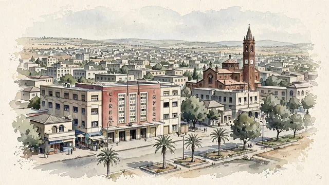
What guided this image
- Landmarks
- Harnet Avenue; The Church of Our Lady of the Rosary; Cinema Impero; Art Deco; Fiat Tagliero
- Viewpoint
- Use a slightly raised oblique view along the Harnet Avenue area, which represents the inhabited modernist center more honestly than the familiar isolated photograph of Fiat Tagliero’s wings.
- Palette
- For this dry highland city, explicitly shift the greens toward grey-green, olive, dusty sage and pale khaki; slate-grey shadows and cool pale wall washes should carry more area than the limited avenue planting.
- Guarded against
- Avoid making Asmara look like an Italian Mediterranean seaport, a dense Ottoman medina, or a lush high-mountain resort of wooden chalets.
Population563,930Wikidata: 963,000
Coordinates15.34°N, 38.93°E
Elevation2,325 m
Area12,158 km²
Time zoneAfrica/AsmaraUTC+3
Solar noon12:24clock runs 0.4 h ahead of the sun
Through the Earth
Dig straight through the Earth from Asmara and you surface nearest to Otepa, French Polynesia — 308 km from the exact antipodal point.
Nearest cities in the atlas
| Sanaa | YE | 566 km |
| Djibouti | DJ | 618 km |
| Makkah | SA | 684 km |
| Jeddah | SA | 684 km |
| Khartoum | SD | 686 km |
| Khartoum North | SD | 687 km |
| Omdurman | SD | 692 km |
| Addis Ababa | ET | 703 km |
Twinned cities
- Khartoum SD
1 of 5 twinned cities are in this atlas. See the full network →