
City
Jepara
Indonesia
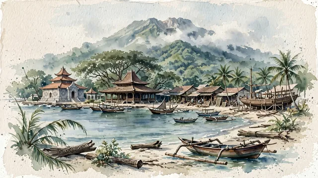
What guided this image
- Landmarks
- Mantingan Mosque; Pendopo Kabupaten Jepara; Jalan Senenan and Tahunan; Java Sea; Mount Muria; lush coastal Central Javan flora; Sultanate of Demak and Kalinyamat
- Viewpoint
- Favor the classic viewpoint looking across Bandengan Beach or the coastal boatbuilding wharves toward the sea with coconut palms and traditional wooden boats in the foreground, the wooden artisan structures and joglo pavilions in the middle-ground, and the misty volcanic silhouette of Mount Muria rising in the background.
- Palette
- Green should be the predominant color, especially in the thick teak forests on the slopes of Mount Muria, ancient banyans on the alun-alun, and coastal coconut palms.
Population1,257,912
Coordinates6.59°S, 110.67°E
Elevation768 m
Area168 km²
Time zoneAsia/JakartaUTC+7
Solar noon11:37clock runs 0.4 h behind the sun
Through the Earth
Dig straight through the Earth from Jepara and you surface nearest to Elorza, Venezuela — 56 km from the exact antipodal point.
Nearest cities in the atlas
| Semarang | ID | 52 km |
| Surabaya | ID | 241 km |
| Bandung | ID | 340 km |
| Bekasi | ID | 409 km |
| Jakarta | ID | 424 km |
| Depok | ID | 426 km |
| Bogor | ID | 429 km |
| South Tangerang | ID | 438 km |
Twinned cities
Wikidata records no twinned cities for Jepara inside this atlas.