
City
Navi Mumbai
India
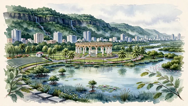
What guided this image
- Landmarks
- Utsav Chowk; Central Park Kharghar; Parsik Hill and the Kharghar Hills; Palm Beach Road; clean modern township urban planning; lush Konkan and Western Ghats flora; Western Ghats
- Viewpoint
- Favor the classic viewpoint looking across the landscape toward the signature landmarks of Navi Mumbai, showing regional foliage and foreground textures, the iconic architectural monuments in the middle-ground, and the distant horizon fading in the background.
- Palette
- Green should be the predominant color, especially in rain trees along Kharghar avenues, coconut palms, and dense monsoon greenery clothing Parsik Hill.
Population2,600,000Wikidata: 1,119,477
Coordinates19.04°N, 73.02°E
Elevation0 m
Area344 km²
Time zoneAsia/KolkataUTC+5:30
Solar noon12:38clock runs 0.6 h ahead of the sun
Through the Earth
Dig straight through the Earth from Navi Mumbai and you surface in open ocean, nearest to Hanga Roa, Chile — 936 km from the exact antipodal point.
Nearest cities in the atlas
| Mumbai | IN | 15 km |
| Thāne | IN | 19 km |
| Dombivali | IN | 21 km |
| Kalyān | IN | 26 km |
| Virār | IN | 52 km |
| Pimpri-Chinchwad | IN | 94 km |
| Pimpri | IN | 95 km |
| Shivaji Nagar | IN | 104 km |
Twinned cities
- Caracas VE
1 of 1 twinned cities are in this atlas. See the full network →