
City
Bratislava
Capital of Slovakia
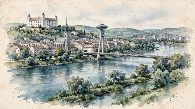
What guided this image
- Landmarks
- Bratislava Castle; Saint Martin’s Cathedral; Most SNP; The old town; Michael’s Gate
- Viewpoint
- Use the conventional view from the Petržalka bank toward the castle and old city, preserving the modern SNP bridge and ordinary riverfront buildings so the panorama does not become an entirely medieval postcard.
- Palette
- Muted botanical green should predominate in the real riverbank and castle-slope planting, with blue-green Danube water and slate-grey urban shadows balancing the pale castle and subdued roofs.
- Guarded against
- Avoid making Bratislava look like Prague with Charles Bridge and Prague Castle, Budapest with its Parliament building, or a snowbound Alpine resort.
Population423,737Wikidata: 417,389
Coordinates48.15°N, 17.11°E
Elevation152 m
Area368 km²
Time zoneEurope/BratislavaUTC+1
Solar noon11:52clock runs 0.1 h behind the sun
Through the Earth
Dig straight through the Earth from Bratislava and you surface in open ocean, nearest to Waitangi, New Zealand — 1,152 km from the exact antipodal point.
Nearest cities in the atlas
| Vienna | AT | 55 km |
| Budapest | HU | 161 km |
| Pest | HU | 164 km |
| Zagreb | HR | 274 km |
| Prague | CZ | 291 km |
| Ljubljana | SI | 305 km |
| Munich | DE | 410 km |
| Belgrade | RS | 453 km |
Twinned cities
- Alexandria EG
- Dublin IE
- Ho Chi Minh City VN
- Jerusalem IL
- Kyiv UA
- Ljubljana SI
- Moscow RU
- Prague CZ
- Sofia BG
- Vienna AT
- Vilnius LT
- Yerevan AM
12 of 30 twinned cities are in this atlas. See the full network →