
City
Budapest
Capital of Hungary
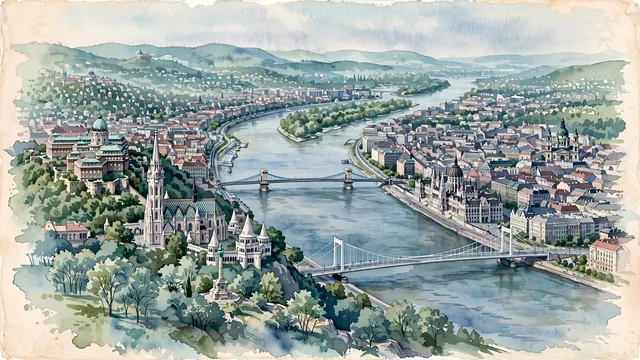
What guided this image
- Landmarks
- Buda Castle; Matthias Church; Hungarian Parliament Building; Széchenyi Chain Bridge; St. Stephen's Basilica; Gellért Hill; Margaret Island; Pest
- Viewpoint
- Favor a slightly elevated viewpoint from Gellért Hill, looking north along the Danube, with Castle Hill on the left, Pest on the right, bridges crossing the river, and the Parliament further upstream.
- Palette
- Green should be the predominant color, especially on Gellért Hill, the trees of Castle Hill, Margaret Island, the Buda Hills, and in the overall visual impression.
- Guarded against
- Avoid making Budapest look like Vienna, Prague, Belgrade, or London, and avoid Mediterranean or Alpine character.
Population1,741,041Wikidata: 1,744,665
Coordinates47.50°N, 19.04°E
Elevation117 m
Area525 km²
Time zoneEurope/BudapestUTC+1
Solar noon11:44clock runs 0.3 h behind the sun
Through the Earth
Dig straight through the Earth from Budapest and you surface in open ocean, nearest to Waitangi, New Zealand — 1,271 km from the exact antipodal point.
Nearest cities in the atlas
| Pest | HU | 3 km |
| Bratislava | SK | 161 km |
| Vienna | AT | 214 km |
| Zagreb | HR | 300 km |
| Belgrade | RS | 320 km |
| Ljubljana | SI | 381 km |
| Sarajevo | BA | 409 km |
| Prague | CZ | 444 km |
Twinned cities
- Ankara TR
- Bangkok TH
- Beijing CN
- Berlin DE
- Bucharest RO
- Chongqing CN
- Daejeon KR
- Damascus SY
- Dublin IE
- Fort Worth US
- Kyiv UA
- Lisbon PT
- Madrid ES
- Nashik IN
- New York City US
- Osaka JP
- Saint Petersburg RU
- São Paulo BR
- Sarajevo BA
- Shanghai CN
- Tbilisi GE
- Tehran IR
- Vienna AT
- Vilnius LT
- Warsaw PL
- Zagreb HR
26 of 39 twinned cities are in this atlas. See the full network →