
City
Jodhpur
India
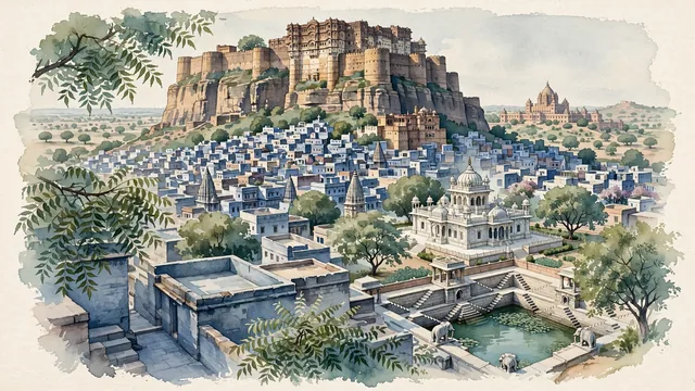
What guided this image
- Landmarks
- Moti Mahal and Phool Mahal; Jaswant Thada; Toorji Ka Jhalra; Umaid Bhawan Palace; lush arid and desert oasis flora; Rathore Rajput
- Viewpoint
- Favor the classic viewpoint looking up from the old town of Brahmpuri or from Jaswant Thada toward the towering cliff and ramparts of Mehrangarh Fort, showing neem tree branches and blue flat rooftops in the foreground, the dense blue city lanes and sheer vertical sandstone cliff in the middle-ground, and the colossal palace bastions of Mehrangarh Fort crowning the rock against the soft desert sky in the background.
- Palette
- Green should be the predominant color, especially in the thick canopies of neem and khejri trees around the base of the fort, Jaswant Thada gardens, and stepwell enclaves.
- Guarded against
- Not Jaipur, Udaipur, or Jaisalmer
Population1,056,191Wikidata: 1,033,918
Coordinates26.27°N, 73.01°E
Elevation231 m
Area289,850,000 km²
Time zoneAsia/KolkataUTC+5:30
Solar noon12:38clock runs 0.6 h ahead of the sun
Through the Earth
Dig straight through the Earth from Jodhpur and you surface nearest to Hanga Roa, Chile — 260 km from the exact antipodal point.
Nearest cities in the atlas
| Jaipur | IN | 286 km |
| Kota | IN | 308 km |
| Ahmedabad | IN | 363 km |
| Gorakhpur | IN | 440 km |
| Vadodara | IN | 442 km |
| Multan | PK | 462 km |
| Najafgarh | IN | 470 km |
| Hyderabad | PK | 473 km |
Twinned cities
Wikidata records no twinned cities for Jodhpur inside this atlas.