
City
Kanpur
India
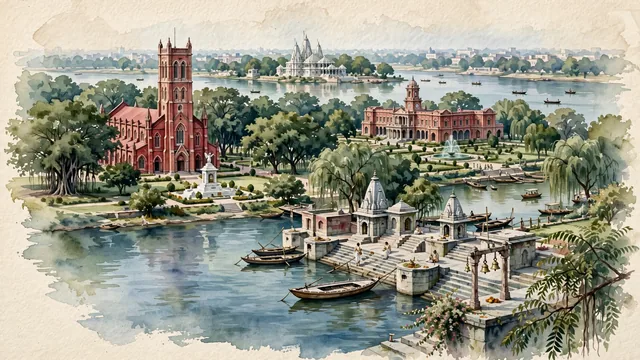
What guided this image
- Landmarks
- Kanpur Memorial Church; Brahmavart Ghat; King Edward Memorial Hall; Moti Jheel; J.K. Temple; Ganges River; lush Indo-Gangetic Doab flora; Vedic
- Viewpoint
- Favor the classic viewpoint looking across the manicured lawns toward the red-brick bell tower of Kanpur Memorial Church, or looking along the holy Ganges River toward Brahmavart Ghat in Bithoor, showing neem branches and stone steps in the foreground, the calm river waters, wooden boats, and historic ghats or church tower in the middle-ground, and the broad river horizon fading in the background.
- Palette
- Green should be the predominant color, especially in the thick canopies of neem, peepal, and banyan trees around Memorial Church, Phool Bagh gardens, and Moti Jheel.
- Guarded against
- Not Lucknow, Varanasi, or Allahabad
Population2,823,249Wikidata: 2,701,324
Coordinates26.47°N, 80.35°E
Elevation126 m
Area3,029,000,000 km²
Time zoneAsia/KolkataUTC+5:30
Solar noon12:09clock runs 0.1 h ahead of the sun
Through the Earth
Dig straight through the Earth from Kanpur and you surface in open ocean, nearest to Hanga Roa, Chile — 972 km from the exact antipodal point.
Nearest cities in the atlas
| Lucknow | IN | 70 km |
| Prayagraj | IN | 188 km |
| Gwalior | IN | 219 km |
| Agra | IN | 244 km |
| Varanasi | IN | 295 km |
| Jabalpur | IN | 369 km |
| Faridabad | IN | 369 km |
| Ghāziābād | IN | 377 km |
Twinned cities
- Alexandria EG
1 of 3 twinned cities are in this atlas. See the full network →