
City
Gwalior
India
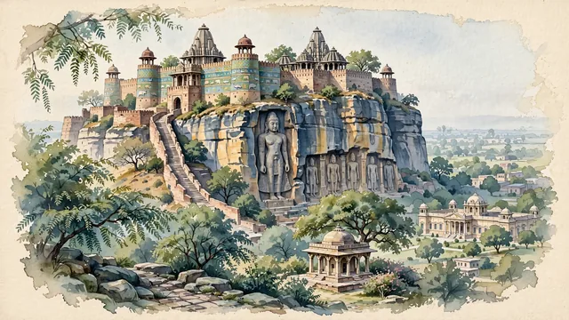
What guided this image
- Landmarks
- Man Mandir Palace; Urwahi Gate; Sas-Bahu Temples; North Indian; Jai Vilas Palace; Tomb of Tansen; lush central Indian dry deciduous flora; Tomar Rajput
- Viewpoint
- Favor the classic viewpoint looking up from the city or eastern approach toward the towering cliff face of Gwalior Fort and Man Mandir Palace, showing neem and tamarind branches in the foreground, the winding stone ramp, colossal sandstone cliff walls, and rock carvings in the middle-ground, and the circular palace towers with turquoise tile bands crowning the plateau against the soft sky in the background.
- Palette
- Green should be the predominant color, especially in the thick canopies of neem, banyan, and tamarind trees at the base of the fort and surrounding gardens.
- Guarded against
- Not Jaipur, Jodhpur, or Agra
Population1,054,420
Coordinates26.23°N, 78.17°E
Time zoneAsia/KolkataUTC+5:30
Solar noon12:17clock runs 0.3 h ahead of the sun
Through the Earth
Dig straight through the Earth from Gwalior and you surface in open ocean, nearest to Hanga Roa, Chile — 761 km from the exact antipodal point.
Nearest cities in the atlas
| Agra | IN | 107 km |
| Kanpur | IN | 219 km |
| Jaipur | IN | 249 km |
| Faridabad | IN | 257 km |
| Kota | IN | 261 km |
| Ghāziābād | IN | 281 km |
| Lucknow | IN | 282 km |
| New Delhi | IN | 282 km |
Twinned cities
Wikidata records no twinned cities for Gwalior inside this atlas.