
City
Karaj
Iran
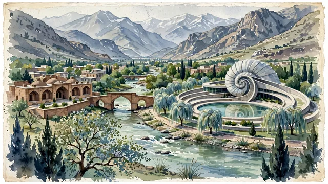
What guided this image
- Landmarks
- Pearl Palace; Safavid Shah Abbasi Caravanserai; Karaj-Chalus River; Alborz Mountain Range; lush Alborz foothill flora; Safavid Silk Road
- Viewpoint
- Favor the classic viewpoint looking up the Karaj River valley toward the dramatic Alborz mountain peaks, showing plane tree foliage and river stones in the foreground, the rushing turquoise water, arched brick bridge, or Pearl Palace curves in the middle-ground, and the colossal snow-dusted Alborz range rising in the background.
- Palette
- Green should be the predominant color, especially in the thick plane and cypress trees of Mehrshahr, riverbank poplars, and orchard gardens.
- Guarded against
- Not Tehran, Qom, or Tabriz
Population1,448,075Wikidata: 1,592,492
Coordinates35.83°N, 50.99°E
Elevation1,341 m
Area162 km²
Time zoneAsia/TehranUTC+3:30
Solar noon12:06clock runs 0.1 h ahead of the sun
Through the Earth
Dig straight through the Earth from Karaj and you surface in open ocean, nearest to Adamstown, Pitcairn Islands — 1,201 km from the exact antipodal point.
Nearest cities in the atlas
| Tehran | IR | 42 km |
| Isfahan | IR | 359 km |
| Tabriz | IR | 487 km |
| Baku | AZ | 515 km |
| Kirkuk | IQ | 598 km |
| Erbil | IQ | 629 km |
| Sadr City | IQ | 656 km |
| Al Başrah al Qadīmah | IQ | 662 km |
Twinned cities
Wikidata records no twinned cities for Karaj inside this atlas.