
City
Maracaibo
Venezuela
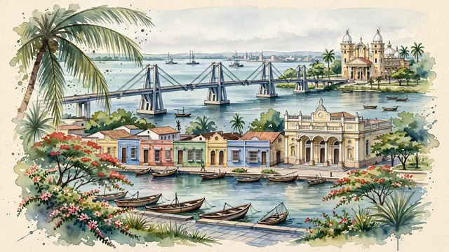
What guided this image
- Landmarks
- General Rafael Urdaneta Bridge; Basilica of Our Lady of Chiquinquirá; Santa Lucía; Teatro Baralt; Lake Maracaibo; Vereda del Lago; lush coastal Venezuelan tropical flora; Lake Maracaibo
- Viewpoint
- Favor the classic viewpoint looking across the landscape toward the signature landmarks of Maracaibo, showing regional foliage and foreground textures, the iconic architectural monuments in the middle-ground, and the distant horizon fading in the background.
- Palette
- Green should be the predominant color, especially in thick coconut palms along the lakefront, flamboyant trees, and flowering tropical shrubs.
Population1,752,602Wikidata: 1,551,539
Coordinates10.64°N, 71.61°W
Elevation6 m
Area1,393 km²
Time zoneAmerica/CaracasUTC−4
Solar noon12:46clock runs 0.8 h ahead of the sun
Through the Earth
Dig straight through the Earth from Maracaibo and you surface nearest to Flying Fish Cove, Christmas Island — 297 km from the exact antipodal point.
Nearest cities in the atlas
| Barquisimeto | VE | 254 km |
| Barranquilla | CO | 348 km |
| Valencia | VE | 398 km |
| Caracas | VE | 517 km |
| Medellín | CO | 654 km |
| Bogotá | CO | 724 km |
| Port-au-Prince | HT | 882 km |
| Panama City | PA | 886 km |
Twinned cities
- Barranquilla CO
- Cali CO
- Durban ZA
- Guadalajara MX
- Guayaquil EC
- Isfahan IR
- Mexico City MX
- Monterrey MX
- Taichung TW
- Tainan TW
10 of 23 twinned cities are in this atlas. See the full network →