
City
Mexico City
Capital of Mexico
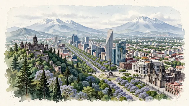
What guided this image
- Landmarks
- Chapultepec Park; Paseo de la Reforma; Angel of Independence; Metropolitan Cathedral; Palacio de Bellas Artes; lush urban greenery; Popocatépetl and Iztaccíhuatl; Porfirian Beaux-Arts
- Viewpoint
- Favor an elevated panoramic viewpoint looking east from near Chapultepec Castle or the western hills, looking down the tree-lined corridor of Paseo de la Reforma toward the downtown core, with modern skyscrapers rising above the green forest canopy and Popocatépetl and Iztaccíhuatl standing majestically in the distant background.
- Palette
- Green should be the predominant color, especially in the vast forest of Chapultepec, the tree-lined avenues of Paseo de la Reforma, and Alameda Central.
- Guarded against
- Not a generic Latin American town or desert village
Population12,294,193Wikidata: 8,918,653
Coordinates19.43°N, 99.13°W
Elevation2,240 m
Area1,485 km²
Time zoneAmerica/Mexico_CityUTC−6
Solar noon12:37clock runs 0.6 h ahead of the sun
Through the Earth
Dig straight through the Earth from Mexico City and you surface in open ocean, nearest to Seabreeze village, British Indian Ocean Territory — 1,632 km from the exact antipodal point.
Nearest cities in the atlas
| Iztapalapa | MX | 11 km |
| Ciudad Nezahualcoyotl | MX | 13 km |
| Ecatepec de Morelos | MX | 20 km |
| Puebla | MX | 105 km |
| Santiago de Querétaro | MX | 184 km |
| León de los Aldama | MX | 326 km |
| Guadalajara | MX | 462 km |
| Zapopan | MX | 467 km |
Twinned cities
- Andorra la Vella AD
- Arequipa PE
- Athens GR
- Beijing CN
- Beirut LB
- Berlin DE
- Bogotá CO
- Buenos Aires AR
- Cairo EG
- Caracas VE
- Chicago US
- Ciudad Juárez MX
- Doha QA
- Guadalajara MX
- Guatemala City GT
- Havana CU
- Houston US
- Istanbul TR
- Jakarta ID
- Kuwait City KW
- Kyiv UA
- La Paz BO
- Lima PE
- Lisbon PT
- London GB
- Los Angeles US
- Madrid ES
- Manila PH
- Maracaibo VE
- Monterrey MX
- Montevideo UY
- Nagoya JP
- New York City US
- Nicosia CY
- Panama City PA
- Paris FR
- Quito EC
- Ranchi IN
- Rio de Janeiro BR
- San Salvador SV
- Santiago CL
- Santo Domingo DO
- São Paulo BR
- Seoul KR
- Stockholm SE
- Sydney AU
- Toronto CA
47 of 59 twinned cities are in this atlas. See the full network →