
City
Port of Spain
Capital of Trinidad and Tobago
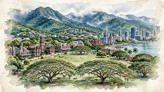
What guided this image
- Landmarks
- Queen's Park Savannah; Victorian-Baroque Queen's Royal College; Red House; Cathedral of the Immaculate Conception; Wrightson Road; Northern Range; giant tropical trees; Caribbean
- Viewpoint
- Favor an elevated viewpoint overlooking Queen's Park Savannah from the south or from the foothills of St. Ann's/Belmont, looking across the vast green circle toward the Magnificent Seven mansions, with the downtown towers and Gulf of Paria on one side and the towering rainforest mountains backing the scene.
- Palette
- Green should be the predominant color, especially in the massive lawn of Queen's Park Savannah, giant saman trees, and the deep rainforest canopy of the Northern Range.
- Guarded against
- Not a generic island beach resort
Population49,031Wikidata: 37,074
Coordinates10.67°N, 61.52°W
Elevation3 m
Area12 km²
Time zoneAmerica/Port_of_SpainUTC−4
Solar noon12:06clock runs 0.1 h ahead of the sun
Through the Earth
Dig straight through the Earth from Port of Spain and you surface nearest to Kahale, Indonesia — 127 km from the exact antipodal point.
Nearest cities in the atlas
| Saint George's | GD | 155 km |
| Kingstown | VC | 279 km |
| Bridgetown | BB | 341 km |
| Castries | LC | 374 km |
| Roseau | DM | 515 km |
| Georgetown | GY | 567 km |
| Caracas | VE | 586 km |
| Valencia | VE | 711 km |
Twinned cities
- Georgetown GY
- Lagos NG
2 of 5 twinned cities are in this atlas. See the full network →
This city sits on
- Trinidad and Tobagocountry
- 10Nparallel
- UTC−4offset