
City
Lagos
Nigeria
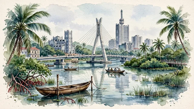
What guided this image
- Landmarks
- Lekki-Ikoyi Link Bridge; Lagos Island; Lagos Lagoon; Lekki Conservation Centre; Brazilian-style Afro-Brazilian; Tarkwa Bay and Victoria Island; lush coastal Nigerian tropical flora; Yoruba and Bini
- Viewpoint
- The Lekki-Ikoyi Link Bridge spanning the lagoon waters with coconut palms and wooden canoes in the foreground, or the view across the lagoon toward the Lagos Island Marina skyline, should occupy most of the image while leaving enough open water, soft sky, and exposed watercolor paper to create depth.
- Palette
- Green should be the predominant color, especially in the thick coconut palms along the coast, mangrove canopies, and lush tropical parklands of Ikoyi and Victoria Island.
- Guarded against
- Not Abuja, Ibadan, or Port Harcourt
Population15,388,000Wikidata: 15,070,000
Coordinates6.45°N, 3.39°E
Elevation34 m
Area1,171 km²
Time zoneAfrica/LagosUTC+1
Solar noon12:46clock runs 0.8 h ahead of the sun
Through the Earth
Dig straight through the Earth from Lagos and you surface in open ocean, nearest to Atafu Village, Tokelau — 507 km from the exact antipodal point.
Nearest cities in the atlas
| Porto-Novo | BJ | 87 km |
| Ibadan | NG | 118 km |
| Lomé | TG | 242 km |
| Benin City | NG | 248 km |
| Ilorin | NG | 261 km |
| Onitsha | NG | 377 km |
| Accra | GH | 409 km |
| Port Harcourt | NG | 442 km |
Twinned cities
- Belo Horizonte BR
- Brussels BE
- Bucharest RO
- Cairo EG
- Fukuoka JP
- Istanbul TR
- Jaipur IN
- Maputo MZ
- Port of Spain TT
- Rio de Janeiro BR
- Taipei TW
- Tbilisi GE
12 of 22 twinned cities are in this atlas. See the full network →