
City
Saint John’s
Capital of Antigua and Barbuda
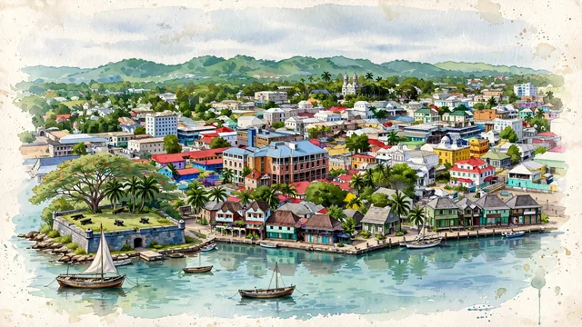
What guided this image
- Landmarks
- Saint John's Cathedral; Redcliffe Quay; Heritage Quay; Court House; Antiguan; Saint John's Harbour; Fort James; tropical flora
- Viewpoint
- Favor an elevated coastal viewpoint looking from across the harbor or the waterfront approaches toward the city, showing the calm turquoise waters and piers in the foreground, with the historic colorful roofs leading up to the twin white cathedral towers in the middle-ground, and the low green hills of Antigua behind.
- Palette
- Green should be the predominant color, especially in the tropical trees throughout the town, cathedral gardens, and the green hills of Antigua in the background.
- Guarded against
- Not a generic Caribbean resort enclave
Population51,737Wikidata: 23,453
Coordinates17.12°N, 61.84°W
Elevation0 m
Area10 km²
Time zoneAmerica/AntiguaUTC−4
Solar noon12:07clock runs 0.1 h ahead of the sun
Through the Earth
Antipode not computed for this city.
Nearest cities in the atlas
| Basseterre | KN | 96 km |
| Roseau | DM | 208 km |
| Castries | LC | 358 km |
| Kingstown | VC | 445 km |
| Bridgetown | BB | 506 km |
| Saint George's | GD | 564 km |
| Port of Spain | TT | 718 km |
| Santo Domingo | DO | 865 km |
Twinned cities
Wikidata records no twinned cities for Saint John’s inside this atlas.
This city sits on
- Antigua and Barbudacountry
- 17Nparallel
- UTC−4offset