
City
Yekaterinburg
Russia
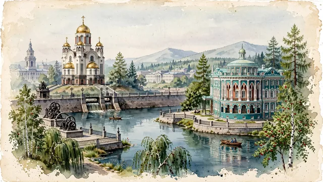
What guided this image
- Landmarks
- Honour of All Saints; Iset River; Neo-Gothic and Moorish; Uralmash and the City Council; Lenin Prospekt; Ural mountain and forest-steppe flora; Romanov
- Viewpoint
- Favor the classic viewpoint looking across the landscape toward the signature landmarks of Yekaterinburg, showing regional foliage and foreground textures, the iconic architectural monuments in the middle-ground, and the distant horizon fading in the background.
- Palette
- Green should be the predominant color, especially in silver birches, weeping willows along the City Pond, and linden trees.
Population1,495,066Wikidata: 4,000
Coordinates56.86°N, 60.62°E
Elevation270 m
Area468 km²
Time zoneAsia/YekaterinburgUTC+5
Solar noon12:58clock runs 1.0 h ahead of the sun
Through the Earth
Dig straight through the Earth from Yekaterinburg and you surface in open ocean, nearest to Puerto Natales, Chile — 3,032 km from the exact antipodal point.
Nearest cities in the atlas
| Chelyabinsk | RU | 196 km |
| Ufa | RU | 374 km |
| Kazan | RU | 718 km |
| Samara | RU | 780 km |
| Omsk | RU | 820 km |
| Astana | KZ | 946 km |
| Nizhniy Novgorod | RU | 1,017 km |
| Novosibirsk | RU | 1,398 km |
Twinned cities
- Birmingham GB
- Bishkek KG
- Guangzhou CN
- Ho Chi Minh City VN
- Incheon KR
5 of 13 twinned cities are in this atlas. See the full network →