
City
Bannu
Pakistan
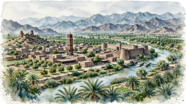
What guided this image
- Landmarks
- Clock Tower of Bannu; Fort Edwardes; Akra; Kurram River; Pashtun; dense, lush agricultural greenery; North Waziristan; Pashtun
- Viewpoint
- Favor an elevated viewpoint overlooking the oasis valley toward the historic town and mountains, showing date palms and irrigation canals in the foreground, the brick Clock Tower and mud-brick compounds in the middle-ground, and the rugged, arid ridges of Waziristan rising in the background.
- Palette
- Green should be the predominant color, especially in the thick date palm groves along the Kurram River, irrigated orchard fields, and mulberry trees.
- Guarded against
- Not Peshawar, Quetta, or Lahore
Population1,357,890Wikidata: 62,191
Coordinates32.99°N, 70.60°E
Elevation3,806 m
Time zoneAsia/KarachiUTC+5
Solar noon12:18clock runs 0.3 h ahead of the sun
Through the Earth
Dig straight through the Earth from Bannu and you surface in open ocean, nearest to Hanga Roa, Chile — 649 km from the exact antipodal point.
Nearest cities in the atlas
| Peshawar | PK | 145 km |
| Kabul | AF | 216 km |
| Rawalpindi | PK | 238 km |
| Islamabad | PK | 241 km |
| Faisalabad | PK | 292 km |
| Multan | PK | 321 km |
| Gujranwala | PK | 349 km |
| Lahore | PK | 387 km |
Twinned cities
Wikidata records no twinned cities for Bannu inside this atlas.