
City
Faisalabad
Pakistan
What guided this image
- Landmarks
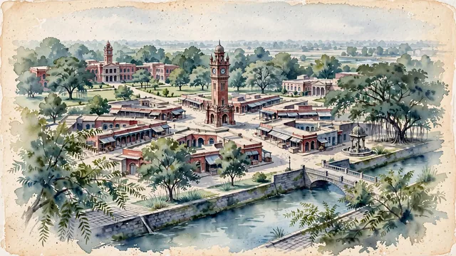
- Victorian-Gothic Ghanta Ghar; University of Agriculture Faisalabad; Rakh Branch Canal; Gumti Water Fountain; lush Punjabi canal-colony flora; Punjab
- Viewpoint
- Favor the classic viewpoint looking toward the Clock Tower from one of the wide bazaar entrances or from the serene banks of the Rakh Branch Canal, showing neem tree branches and street pavers in the foreground, the stately red-brick Clock Tower and arched colonial facades in the middle-ground, and the soft sky and urban tree canopy fading in the background.
- Palette
- Green should be the predominant color, especially in the thick canopies of sheesham and neem trees along the Rakh Canal, UAF botanic lawns, and central roundabouts.
- Guarded against
- Not Lahore, Rawalpindi, or Multan
Population3,800,193Wikidata: 3,203,846
Coordinates31.42°N, 73.09°E
Elevation184 m
Area1,269 km²
Time zoneAsia/KarachiUTC+5
Solar noon12:08clock runs 0.1 h ahead of the sun
Through the Earth
Dig straight through the Earth from Faisalabad and you surface in open ocean, nearest to Hanga Roa, Chile — 534 km from the exact antipodal point.
Nearest cities in the atlas
| Lahore | PK | 120 km |
| Gujranwala | PK | 133 km |
| Amritsar | IN | 171 km |
| Multan | PK | 205 km |
| Rawalpindi | PK | 242 km |
| Islamabad | PK | 256 km |
| Ludhiana | IN | 269 km |
| Bannu | PK | 292 km |
Twinned cities
- Kobe JP
1 of 2 twinned cities are in this atlas. See the full network →