
City
Basrah
Iraq
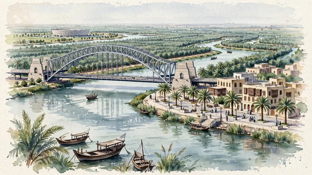
What guided this image
- Landmarks
- Basra Corniche; Shatt; Basra Sports City; Ashar Canal; Mesopotamian; Mesopotamian
- Viewpoint
- Favor an elevated viewpoint along or across the Shatt al-Arab looking north toward the Corniche and the bridge, showing river reflections and wooden bellum boats in the foreground, the sweeping Corniche promenade and bridge span in the middle-ground, and the endless sea of green date palms fading into the background.
- Palette
- Green should be the predominant color, especially in the thick date palm canopies lining both banks of the Shatt al-Arab, river reeds, and Corniche gardens.
- Guarded against
- Not Baghdad, Mosul, or Erbil
Population1,326,564
Coordinates30.51°N, 47.78°E
Elevation5 m
Area181 km²
Time zoneAsia/BaghdadUTC+3
Solar noon11:49clock runs 0.2 h behind the sun
Through the Earth
Dig straight through the Earth from Basrah and you surface in open ocean, nearest to Adamstown, Pitcairn Islands — 640 km from the exact antipodal point.
Nearest cities in the atlas
| Al Başrah al Qadīmah | IQ | 4 km |
| Kuwait City | KW | 128 km |
| Karbala | IQ | 427 km |
| Isfahan | IR | 439 km |
| Sadr City | IQ | 448 km |
| Baghdad | IQ | 448 km |
| Shiraz | IR | 468 km |
| Dammam | SA | 507 km |
Twinned cities
2 of 4 twinned cities are in this atlas. See the full network →