
City
Dar es Salaam
Tanzania
What guided this image
- Landmarks
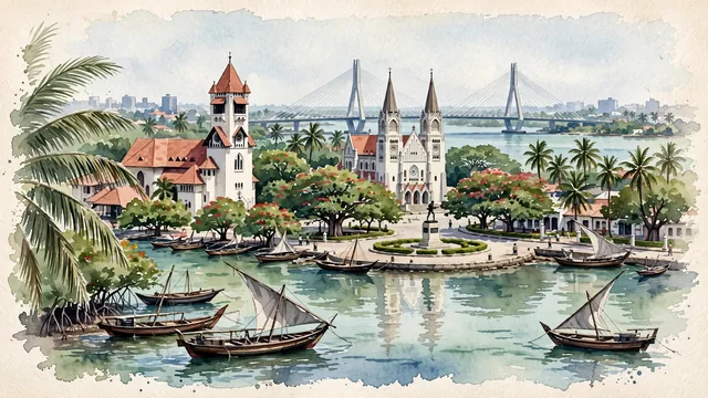
- Azania Front Lutheran Church; St. Joseph's Metropolitan Cathedral; Nyerere Bridge; Swahili; Kivukoni Front; Askari Monument; lush tropical coastal East African flora; East African Indian Ocean
- Viewpoint
- Favor the classic viewpoint looking across the harbor from the water or Kivukoni Ferry approach toward the historic waterfront, showing coconut palm fronds and wooden dhows in the foreground, the whitewashed bell tower of Azania Front Church and waterfront trees in the middle-ground, and the modern city skyline and Kigamboni Bridge fading in the background.
- Palette
- Green should be the predominant color, especially in the thick canopies of flame trees along Kivukoni Front, coconut palms along Msasani, and coastal mangroves.
- Guarded against
- Not Mombasa, Stone Town Zanzibar, or Maputo
Population5,383,728Wikidata: 4,364,541
Coordinates6.82°S, 39.27°E
Elevation12 m
Area1,393 km²
Time zoneAfrica/Dar_es_SalaamUTC+3
Solar noon12:23clock runs 0.4 h ahead of the sun
Through the Earth
Dig straight through the Earth from Dar es Salaam and you surface in open ocean, nearest to Taiohae, French Polynesia — 1,750 km from the exact antipodal point.
Nearest cities in the atlas
| Mombasa | KE | 311 km |
| Dodoma | TZ | 397 km |
| Nairobi | KE | 673 km |
| Moroni | KM | 697 km |
| Mwanza | TZ | 852 km |
| Kakamega | KE | 935 km |
| Lilongwe | MW | 995 km |
| Kampala | UG | 1,087 km |
Twinned cities
- Hamburg DE
1 of 1 twinned cities are in this atlas. See the full network →