
City
Mombasa
Kenya
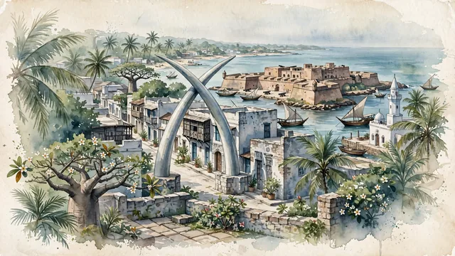
What guided this image
- Landmarks
- UNESCO World Heritage Fort Jesus; Mombasa Tusks; Mombasa Old Town; Old Port; Mandhry Mosque; lush Kenyan coastal Swahili flora; Portuguese and Omani
- Viewpoint
- Favor the classic viewpoint looking across the landscape toward the signature landmarks of Mombasa, showing regional foliage and foreground textures, the iconic architectural monuments in the middle-ground, and the distant horizon fading in the background.
- Palette
- Green should be the predominant color, especially in swaying coconut palms, giant coastal baobabs, and flowering frangipani trees.
Population1,208,333Wikidata: 1,300,000
Coordinates4.05°S, 39.66°E
Elevation50 m
Area295 km²
Time zoneAfrica/NairobiUTC+3
Solar noon12:21clock runs 0.4 h ahead of the sun
Through the Earth
Dig straight through the Earth from Mombasa and you surface in open ocean, nearest to Taiohae, French Polynesia — 1,441 km from the exact antipodal point.
Nearest cities in the atlas
| Dar es Salaam | TZ | 311 km |
| Nairobi | KE | 441 km |
| Dodoma | TZ | 494 km |
| Kakamega | KE | 728 km |
| Mwanza | TZ | 769 km |
| Kampala | UG | 925 km |
| Mogadishu | SO | 926 km |
| Moroni | KM | 938 km |
Twinned cities
- Durban ZA
- Fuzhou CN
- Lianyungang CN
3 of 8 twinned cities are in this atlas. See the full network →