
City
Nairobi
Capital of Kenya
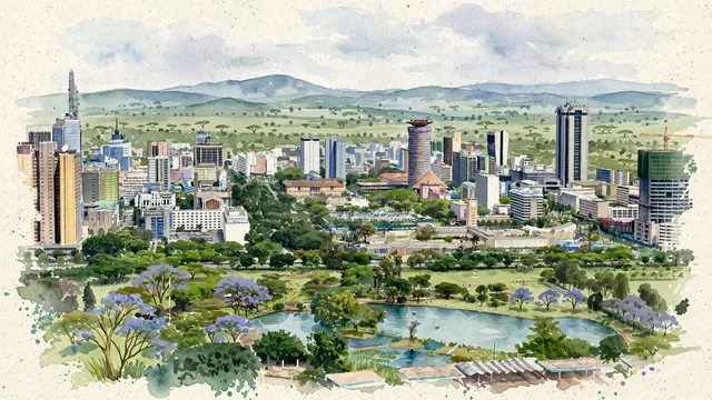
What guided this image
- Landmarks
- Kenyatta International Convention Centre; Uhuru Park; Uhuru Highway and Kenyatta Avenue; Ngong Hills; Nairobi National Park; Nairobi National Museum; Pan-African
- Viewpoint
- Favor an elevated viewpoint looking east or northeast across the lake and lawns of Uhuru Park toward the downtown core, showing the park greenery in the foreground, with the KICC tower and central high-rises rising directly beyond the trees, and the gentle Ngong Hills or open sky framing the background.
- Palette
- Green should be the predominant color, especially in the vast lawns and tree canopies of Uhuru Park, roadside jacarandas and fever trees, and the surrounding green ridges.
- Guarded against
- Not a generic African savanna or futuristic sci-fi city
Population4,397,073Wikidata: 3,138,369
Coordinates1.28°S, 36.82°E
Elevation1,661 m
Area696 km²
Time zoneAfrica/NairobiUTC+3
Solar noon12:33clock runs 0.5 h ahead of the sun
Through the Earth
Dig straight through the Earth from Nairobi and you surface in open ocean, nearest to Taiohae, French Polynesia — 1,183 km from the exact antipodal point.
Nearest cities in the atlas
| Kakamega | KE | 288 km |
| Mombasa | KE | 441 km |
| Mwanza | TZ | 457 km |
| Kampala | UG | 504 km |
| Dodoma | TZ | 557 km |
| Dar es Salaam | TZ | 673 km |
| Kigali | RW | 755 km |
| Gitega | BI | 803 km |
Twinned cities
- Kunming CN
- Rio de Janeiro BR
2 of 7 twinned cities are in this atlas. See the full network →