
City
Ecatepec de Morelos
Mexico
What guided this image
- Landmarks
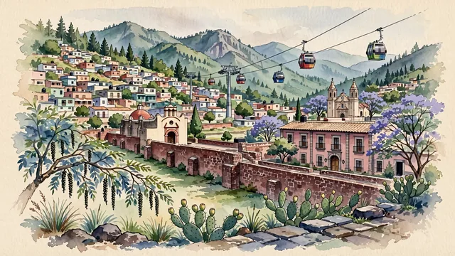
- Albarradón de San Cristóbal; Casa de Morelos; Mexicable; Sierra de Guadalupe; San Cristóbal Ecatepec; lush high-plateau flora; Aztec
- Viewpoint
- Favor the classic viewpoint looking toward the Sierra de Guadalupe across the historic Albarradón or central square, showing pepper tree branches and nopal cacti in the foreground, the colonial stone causeway arches, townhouses, and soaring cable cars in the middle-ground, and the rocky green ridges of Sierra de Guadalupe rising in the background.
- Palette
- Green should be the predominant color, especially in the thick pine, cedar, and oak reforestations of the Sierra de Guadalupe, pepper trees (pirul), and park canopies.
- Guarded against
- Not central Mexico City, Puebla, or Toluca
Population1,645,352Wikidata: 1,929,926
Coordinates19.60°N, 99.06°W
Elevation2,250 m
Area160 km²
Time zoneAmerica/Mexico_CityUTC−6
Solar noon12:36clock runs 0.6 h ahead of the sun
Through the Earth
Dig straight through the Earth from Ecatepec de Morelos and you surface in open ocean, nearest to Seabreeze village, British Indian Ocean Territory — 1,651 km from the exact antipodal point.
Nearest cities in the atlas
| Mexico City | MX | 20 km |
| Ciudad Nezahualcoyotl | MX | 23 km |
| Iztapalapa | MX | 27 km |
| Puebla | MX | 108 km |
| Santiago de Querétaro | MX | 177 km |
| León de los Aldama | MX | 321 km |
| Guadalajara | MX | 464 km |
| Zapopan | MX | 469 km |
Twinned cities
Wikidata records no twinned cities for Ecatepec de Morelos inside this atlas.