
City
New Delhi
Capital of India
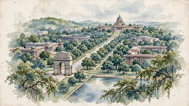
What guided this image
- Landmarks
- India Gate; Rashtrapati Bhavan; North and South Secretariat; Old Parliament; Kartavya Path; the dense, lush green urban forest of Lutyens' Delhi; Lotus Temple; Delhi
- Viewpoint
- Favor an elevated viewpoint looking west along Kartavya Path from near India Gate toward Raisina Hill, showing the long formal lawns, reflection canals, and tree canopies leading up to the grand dome of Rashtrapati Bhavan on its rise.
- Palette
- Green should be the predominant color, especially in the dense canopy of roadside trees, the expansive lawns of Kartavya Path, and public gardens.
- Guarded against
- Not Old Delhi's dense walled city or a generic Indian scene
Population317,797Wikidata: 249,998
Coordinates28.62°N, 77.21°E
Elevation216 m
Area43 km²
Time zoneAsia/KolkataUTC+5:30
Solar noon12:21clock runs 0.4 h ahead of the sun
Through the Earth
Dig straight through the Earth from New Delhi and you surface in open ocean, nearest to Hanga Roa, Chile — 672 km from the exact antipodal point.
Nearest cities in the atlas
| Delhi | IN | 4 km |
| Najafgarh | IN | 22 km |
| Ghāziābād | IN | 23 km |
| Faridabad | IN | 25 km |
| Meerut | IN | 63 km |
| Gorakhpur | IN | 176 km |
| Agra | IN | 179 km |
| Jaipur | IN | 235 km |
Twinned cities
- Moscow RU
1 of 3 twinned cities are in this atlas. See the full network →