
City
Ottawa
Capital of Canada
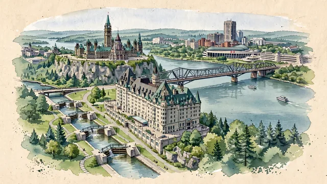
What guided this image
- Landmarks
- Library of Parliament; Fairmont Château Laurier; Rideau Canal; Alexandra Bridge; Canadian Museum of History; dense stands of northern deciduous and pine forests; Major's Hill Park; Ottawa River
- Viewpoint
- Favor an elevated viewpoint overlooking the canal entrance and river (such as from Major's Hill Park or near the Plaza Bridge), looking northwest across the Rideau Canal locks toward Parliament Hill, with the Peace Tower and Library of Parliament crowning the limestone bluff and the Gatineau Hills across the river.
- Palette
- Green should be the predominant color, especially in the oxidized copper-green roofs of Parliament and Château Laurier, the lush lawns of Major's Hill Park, and the forested slopes of the Gatineau Hills.
- Guarded against
- Avoid making Ottawa look like Montreal (no Mont-Royal cross) or Toronto (no CN Tower).
Population1,017,449Wikidata: 934,243
Coordinates45.41°N, 75.70°W
Elevation70 m
Area2,779 km²
Time zoneAmerica/TorontoUTC−5
Solar noon12:03clock runs 0.0 h ahead of the sun
Through the Earth
Dig straight through the Earth from Ottawa and you surface in open ocean, nearest to Augusta, Australia — 1,540 km from the exact antipodal point.
Nearest cities in the atlas
| Montréal | CA | 165 km |
| Toronto | CA | 349 km |
| The Bronx | US | 528 km |
| Manhattan | US | 534 km |
| New York City | US | 540 km |
| Queens | US | 547 km |
| Brooklyn | US | 548 km |
| Philadelphia | US | 609 km |
Twinned cities
- Beijing CN
- Buenos Aires AR
- Cairo EG
3 of 7 twinned cities are in this atlas. See the full network →