
City
Queens
United States
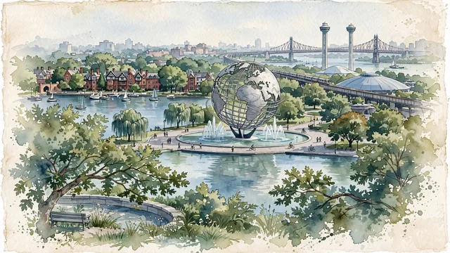
What guided this image
- Landmarks
- New York World's Fair; New York State Pavilion; Forest Hills Gardens; Flushing Bay and Meadow Lake; Queensboro Bridge; lush northeastern American urban flora; World's Fair
- Viewpoint
- Favor the classic viewpoint looking across the landscape toward the signature landmarks of Queens, showing regional foliage and foreground textures, the iconic architectural monuments in the middle-ground, and the distant horizon fading in the background.
- Palette
- Green should be the predominant color, especially in London plane trees, weeping willows along Meadow Lake, and leafy red oaks.
Population2,316,841Wikidata: 2,230,722
Coordinates40.68°N, 73.84°W
Area461 km²
Time zoneAmerica/New_YorkUTC−5
Solar noon11:55clock runs 0.1 h behind the sun
Through the Earth
Dig straight through the Earth from Queens and you surface in open ocean, nearest to Augusta, Australia — 1,062 km from the exact antipodal point.
Nearest cities in the atlas
| Brooklyn | US | 10 km |
| New York City | US | 15 km |
| Manhattan | US | 16 km |
| The Bronx | US | 19 km |
| Philadelphia | US | 138 km |
| Washington | US | 337 km |
| Montréal | CA | 537 km |
| Ottawa | CA | 547 km |
Twinned cities
Wikidata records no twinned cities for Queens inside this atlas.
This city sits on
- United Statescountry
- 40Nparallel
- UTC−5offset