
City
Perth
Australia
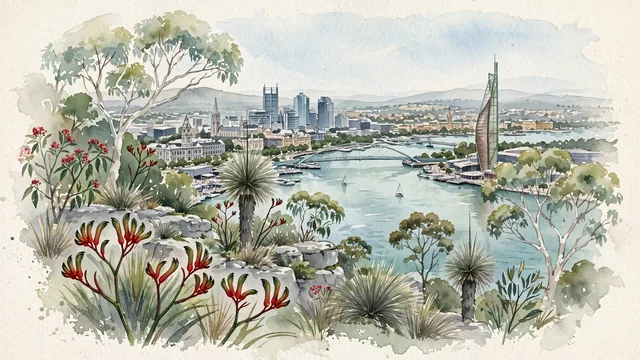
What guided this image
- Landmarks
- Kings Park; Swan Bells Tower; Elizabeth Quay; Perth Town Hall; King Street; unique Western Australian native flora; Western Australian
- Viewpoint
- Favor the classic viewpoint looking across the landscape toward the signature landmarks of Perth, showing regional foliage and foreground textures, the iconic architectural monuments in the middle-ground, and the distant horizon fading in the background.
- Palette
- Green should be the predominant color, especially in lemon-scented gums and eucalyptus canopies in Kings Park, flowering kangaroo paws, and grasstrees.
Population2,309,338Wikidata: 1,972,358
Coordinates31.95°S, 115.86°E
Elevation2 m
Area6,418 km²
Time zoneAustralia/PerthUTC+8
Solar noon12:17clock runs 0.3 h ahead of the sun
Through the Earth
Dig straight through the Earth from Perth and you surface nearest to Smith's Parish, Bermuda — 69 km from the exact antipodal point.
Nearest cities in the atlas
| Adelaide | AU | 2,131 km |
| Melbourne | AU | 2,721 km |
| Surabaya | ID | 2,765 km |
| Dili | TL | 2,787 km |
| Semarang | ID | 2,832 km |
| Jepara | ID | 2,871 km |
| Bandung | ID | 2,912 km |
| Bogor | ID | 2,973 km |
Twinned cities
- Chengdu CN
1 of 1 twinned cities are in this atlas. See the full network →