
City
Port-Vila
Capital of Vanuatu
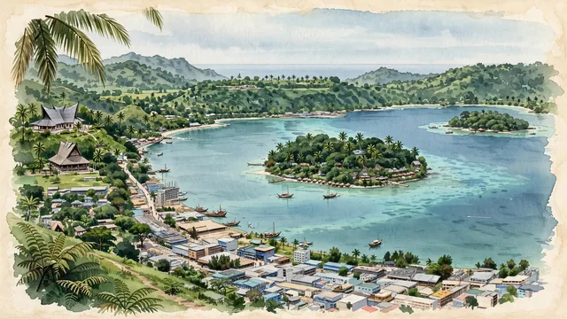
What guided this image
- Landmarks
- Iririki Island; Lini Highway; Vanuatu Parliament House; Chief Roi Mata; Ni-Vanuatu
- Viewpoint
- Favor an elevated viewpoint from the hills overlooking Vila Bay (such as from the heights near the Parliament House or Hospital Hill), looking across the harbor toward Iririki Island and the open Pacific Ocean, with the waterfront town curving along the shore in the foreground/middle-ground.
- Palette
- Green should be the predominant color, especially in the thick rainforest canopy of Iririki Island, hillside vegetation, and coastal coconut palms.
- Guarded against
- Not a generic tropical tourist enclave
Population35,901Wikidata: 44,040
Coordinates17.74°S, 168.31°E
Elevation59 m
Area24 km²
Time zonePacific/EfateUTC+11
Solar noon11:47clock runs 0.2 h behind the sun
Through the Earth
Dig straight through the Earth from Port-Vila and you surface nearest to El Ghediya, Mauritania — 15 km from the exact antipodal point.
Nearest cities in the atlas
| Suva | FJ | 1,071 km |
| Honiara | SB | 1,292 km |
| Funafuti | TV | 1,561 km |
| Nuku‘alofa | TO | 1,769 km |
| Brisbane | AU | 1,903 km |
| Yaren | NR | 1,917 km |
| Apia | WS | 2,174 km |
| Tarawa | KI | 2,181 km |
Twinned cities
- Shanghai CN
1 of 3 twinned cities are in this atlas. See the full network →