
City
Suva
Capital of Fiji
What guided this image
- Landmarks
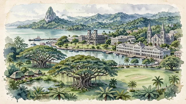
- Joske's Thumb; Government Buildings; Albert Park; Grand Pacific Hotel; Sacred Heart Cathedral; Victoria Parade and Queen Elizabeth Drive; Fijian Bure; lush botanical vegetation
- Viewpoint
- Favor an elevated coastal viewpoint looking west across Albert Park and Government Buildings toward Suva Harbour, showing the green park grounds in the foreground, the historic colonial architecture in the middle-ground, and the harbor waters backed by the silhouette of Joske's Thumb.
- Palette
- Green should be the predominant color, especially in the thick rainforest hills of Viti Levu, the expansive turf of Albert Park, and the giant banyans of Thurston Gardens.
- Guarded against
- Not a generic beach resort island
Population77,366Wikidata: 88,271
Coordinates18.14°S, 178.43°E
Elevation0 m
Area2,048 km²
Time zonePacific/FijiUTC+12
Solar noon12:06clock runs 0.1 h ahead of the sun
Through the Earth
Dig straight through the Earth from Suva and you surface nearest to Gourma Rharous, Mali — 145 km from the exact antipodal point.
Nearest cities in the atlas
| Nuku‘alofa | TO | 746 km |
| Port-Vila | VU | 1,071 km |
| Funafuti | TV | 1,073 km |
| Apia | WS | 1,152 km |
| Auckland | NZ | 2,111 km |
| Honiara | SB | 2,216 km |
| Tarawa | KI | 2,246 km |
| Yaren | NR | 2,325 km |
Twinned cities
Wikidata records no twinned cities for Suva inside this atlas.