
City
Suwon
South Korea
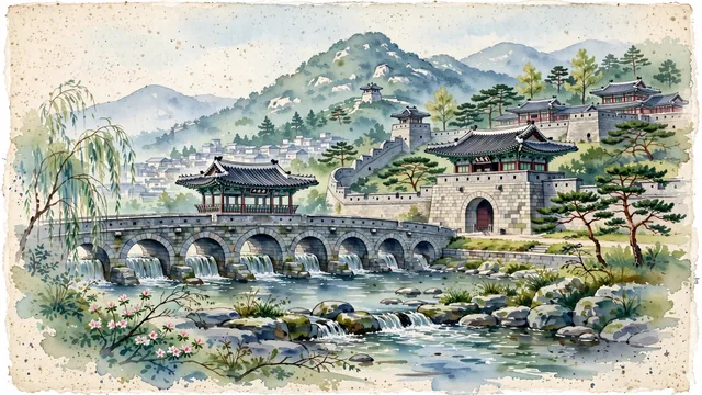
What guided this image
- Landmarks
- Hwaseong Fortress; Janganmun Gate; Hwahongmun; Hwaseong Haenggung; Mount Paldal; Korean peninsula flora; Joseon Dynasty
- Viewpoint
- Favor the classic viewpoint looking across the landscape toward the signature landmarks of Suwon, showing regional foliage and foreground textures, the iconic architectural monuments in the middle-ground, and the distant horizon fading in the background.
- Palette
- Green should be the predominant color, especially in Korean red pines on fortress walls, weeping willows along Suwoncheon stream, and ancient zelkovas.
Population1,234,582Wikidata: 1,234,300
Coordinates37.29°N, 127.01°E
Elevation66 m
Area121 km²
Time zoneAsia/SeoulUTC+9
Solar noon12:32clock runs 0.5 h ahead of the sun
Through the Earth
Dig straight through the Earth from Suwon and you surface nearest to La Paloma, Uruguay — 311 km from the exact antipodal point.
Nearest cities in the atlas
| Seoul | KR | 31 km |
| Incheon | KR | 33 km |
| Goyang-si | KR | 44 km |
| Daejeon | KR | 110 km |
| Daegu | KR | 212 km |
| Pyongyang | KP | 223 km |
| Gwangju | KR | 238 km |
| Changwon | KR | 274 km |
Twinned cities
7 of 12 twinned cities are in this atlas. See the full network →
This city sits on
- South Koreacountry
- 37Nparallel
- UTC+9offset