
City
Curitiba
Brazil
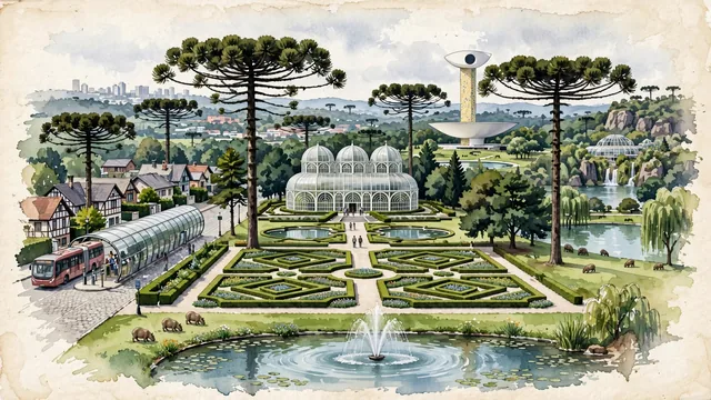
What guided this image
- Landmarks
- Botanical Garden of Curitiba; Araucaria; Oscar Niemeyer Museum; Wire Opera House; Barigui Park; Art Nouveau and Niemeyer
- Viewpoint
- Favor the classic viewpoint across the geometric French parterres of Jardim Botânico looking toward the triple-domed glass greenhouse, showing manicured hedges and flowers in the foreground, the sparkling Art Nouveau glasshouse and fountain in the middle-ground, and the iconic, soaring silhouettes of Araucaria pines and soft city horizon in the background.
- Palette
- Green should be the predominant color, especially in the dark olive-green candelabra canopies of Araucaria pines, manicured French gardens of Jardim Botânico, and Barigui Park turf.
- Guarded against
- Not São Paulo, Porto Alegre, or Rio de Janeiro
Population1,948,626Wikidata: 1,587,315
Coordinates25.43°S, 49.27°W
Elevation935 m
Area431 km²
Time zoneAmerica/Sao_PauloUTC−3
Solar noon12:17clock runs 0.3 h ahead of the sun
Through the Earth
Dig straight through the Earth from Curitiba and you surface nearest to Zaisho, Japan — 67 km from the exact antipodal point.
Nearest cities in the atlas
| São Paulo | BR | 338 km |
| Guarulhos | BR | 353 km |
| Campinas | BR | 359 km |
| Porto Alegre | BR | 547 km |
| Rio de Janeiro | BR | 678 km |
| Belo Horizonte | BR | 821 km |
| Asunción | PY | 842 km |
| Goiânia | BR | 973 km |
Twinned cities
- Asunción PY
- Copenhagen DK
- Córdoba AR
- Durban ZA
- Guadalajara MX
- Hangzhou CN
- Jacksonville US
- Montevideo UY
- Santa Cruz de la Sierra BO
- Santo Domingo DO
- Suwon KR
11 of 20 twinned cities are in this atlas. See the full network →