
City
Gwangju
South Korea
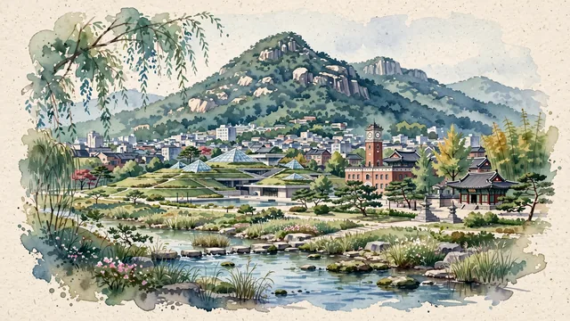
What guided this image
- Landmarks
- Mudeungsan National Park; Asia Culture Center; Jeungsimsa Temple; Gwangjucheon Stream; Western-style; Damyang and Soswaewon Garden; lush Honam temperate flora
- Viewpoint
- Favor the classic viewpoint looking across the city or stream toward the majestic peak of Mount Mudeungsan, showing willow branches and stream stones in the foreground, the clean civic architecture, ACC green roof terraces, and low-rise rooftops in the middle-ground, and the massive, forested mountain wall of Mudeungsan with its crown of basalt columns rising in the background.
- Palette
- Green should be the predominant color, especially in the thick pine and oak forests of Mudeungsan, ACC stepped lawn roofs, and willow-lined stream corridors.
- Guarded against
- Not Seoul, Busan, or Daegu
Population1,401,235Wikidata: 1,501,557
Coordinates35.15°N, 126.92°E
Area501 km²
Time zoneAsia/SeoulUTC+9
Solar noon12:32clock runs 0.5 h ahead of the sun
Through the Earth
Dig straight through the Earth from Gwangju and you surface nearest to La Paloma, Uruguay — 113 km from the exact antipodal point.
Nearest cities in the atlas
| Daejeon | KR | 140 km |
| Changwon | KR | 160 km |
| Daegu | KR | 171 km |
| Busan | KR | 192 km |
| Ulsan | KR | 222 km |
| Suwon | KR | 238 km |
| Incheon | KR | 258 km |
| Seoul | KR | 269 km |
Twinned cities
- Guangzhou CN
- Medan ID
- San Antonio US
- Sendai JP
- Tainan TW
5 of 5 twinned cities are in this atlas. See the full network →
This city sits on
- South Koreacountry
- 35Nparallel
- UTC+9offset