
City
Valletta
Capital of Malta
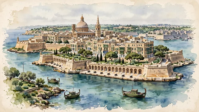
What guided this image
- Landmarks
- Basilica of Our Lady of Mount Carmel; Fort Saint Elmo; Upper Barrakka Gardens; Grand Harbour; Three Cities; High Baroque
- Viewpoint
- Favor the classic elevated viewpoint from across the harbor (such as from Sliema looking across Marsamxett Harbour or from the Three Cities across Grand Harbour), showing the sheer honey-limestone bastions rising from the water, the famous dome of Mount Carmel and spire of St. Paul's anchoring the middle-ground, and the Mediterranean horizon in the background.
- Palette
- Green should be the predominant color, especially in the landscaped gardens of Upper and Lower Barrakka, Hastings Gardens, and the distinctive olive-green painted wooden balconies (gallariji).
- Guarded against
- Not a generic Mediterranean island town
Population6,794Wikidata: 6,444
Coordinates35.90°N, 14.51°E
Elevation56 m
Area80 km²
Time zoneEurope/MaltaUTC+1
Solar noon12:02clock runs 0.0 h ahead of the sun
Through the Earth
Dig straight through the Earth from Valletta and you surface in open ocean, nearest to Waitangi, New Zealand — 1,299 km from the exact antipodal point.
Nearest cities in the atlas
| Tripoli | LY | 356 km |
| Tunis | TN | 402 km |
| Rome | IT | 688 km |
| Vatican City | VA | 691 km |
| Tirana | AL | 760 km |
| Podgorica | ME | 834 km |
| Athens | GR | 851 km |
| Skopje | MK | 904 km |
Twinned cities
Wikidata records no twinned cities for Valletta inside this atlas.