
City
Bamako
Capital of Mali
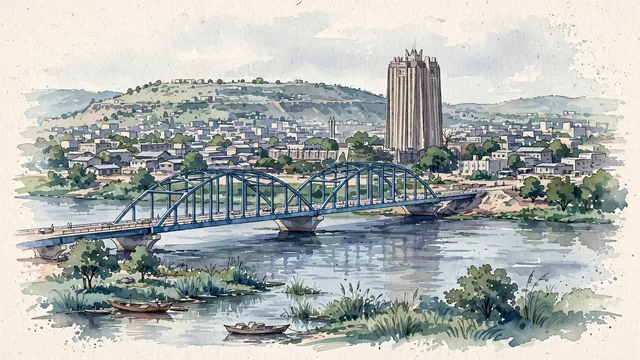
What guided this image
- Landmarks
- The BCEAO Tower; The Martyrs Bridge; Koulouba; Bamako’s; Allow
- Viewpoint
- Use a broad view from the south bank across the Niger toward the northern city and Koulouba, a representative river panorama that keeps the tower and bridge embedded in the wider low-rise capital.
- Palette
- Muted botanical green should predominate along the river and in actual seasonal tree cover, with slate-grey roofs, blue-grey water and subdued neutral ground preserving Bamako’s dry-season-sensitive urban character.
- Guarded against
- Avoid making Bamako look like Djenné with its Great Mosque transplanted into the skyline, a dune-surrounded Saharan caravan town, or the high-rise lagoon waterfront of Abidjan.
Population4,227,569Wikidata: 1,810,366
Coordinates12.61°N, 7.98°W
Elevation350 m
Area245 km²
Time zoneAfrica/BamakoUTC+0
Solar noon12:32clock runs 0.5 h ahead of the sun
Through the Earth
Dig straight through the Earth from Bamako and you surface in open ocean, nearest to Sola, Vanuatu — 504 km from the exact antipodal point.
Nearest cities in the atlas
| Ouagadougou | BF | 701 km |
| Yamoussoukro | CI | 709 km |
| Conakry | GN | 709 km |
| Camayenne | GN | 710 km |
| Freetown | SL | 735 km |
| Monrovia | LR | 767 km |
| Bissau | GW | 832 km |
| Touba | SN | 889 km |
Twinned cities
- Ashgabat TM
- Banjul GM
- Dakar SN
- Nouakchott MR
- São Paulo BR
5 of 11 twinned cities are in this atlas. See the full network →