
City
Barcelona
Spain
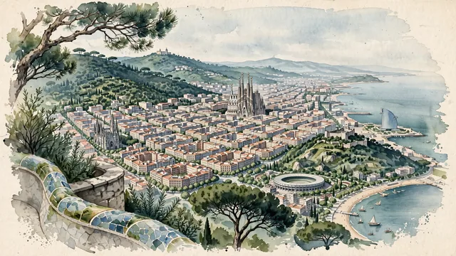
What guided this image
- Landmarks
- Antoni Gaudí's Basílica de la Sagrada Família; Montjuïc Castle; Gothic Quarter; Park Güell; Mediterranean Sea; lush Mediterranean vegetation; Catalan Modernisme
- Viewpoint
- Favor the classic elevated viewpoint from Park Güell, the Bunkers del Carmel, or Montjuïc looking southeast toward the Mediterranean, showing pine trees and stone parapets in the foreground, the octagonal Eixample grid and the towering spires of the Sagrada Família in the middle-ground, and the calm blue Mediterranean horizon in the background.
- Palette
- Green should be the predominant color, especially in the thick pine forests of Collserola, Montjuïc gardens, Park Güell, and the lush plane trees lining the Eixample streets.
- Guarded against
- Not Madrid, Valencia, or a generic Spanish town
Population1,686,208Wikidata: 1,611,822
Coordinates41.39°N, 2.16°E
Elevation9 m
Area101 km²
Time zoneEurope/MadridUTC+1
Solar noon12:51clock runs 0.9 h ahead of the sun
Through the Earth
Dig straight through the Earth from Barcelona and you surface nearest to Waitangi, New Zealand — 303 km from the exact antipodal point.
Nearest cities in the atlas
| Andorra la Vella | AD | 135 km |
| Monaco | MC | 504 km |
| Madrid | ES | 504 km |
| Algiers | DZ | 524 km |
| Milan | IT | 726 km |
| Bern | CH | 748 km |
| Paris | FR | 830 km |
| Vatican City | VA | 856 km |
Twinned cities
- Algiers DZ
- Athens GR
- Buenos Aires AR
- Busan KR
- Cairo EG
- Dubai AE
- Dublin IE
- Fes MA
- Havana CU
- Ho Chi Minh City VN
- Isfahan IR
- Istanbul TR
- Kobe JP
- Köln DE
- Kyiv UA
- Medellín CO
- Monterrey MX
- Montevideo UY
- Montréal CA
- Nizhniy Novgorod RU
- Quito EC
- Rio de Janeiro BR
- Saint Petersburg RU
- Santo Domingo DO
- São Paulo BR
- Sarajevo BA
- Shanghai CN
- Tirana AL
- Wenzhou CN
29 of 45 twinned cities are in this atlas. See the full network →