
City
Rio de Janeiro
Brazil
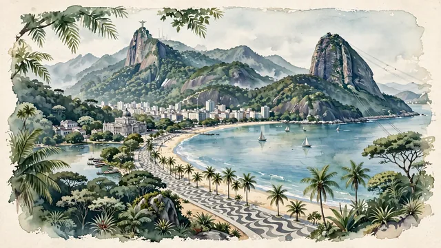
What guided this image
- Landmarks
- Christ the Redeemer; Sugarloaf Mountain; Theatro Municipal; Lagoa Rodrigo de Freitas; lush Atlantic Rainforest (Mata Atlântica) flora; Art Deco
- Viewpoint
- Favor the classic viewpoint looking across the landscape toward the signature landmarks of Rio de Janeiro, showing regional foliage and foreground textures, the iconic architectural monuments in the middle-ground, and the distant horizon fading in the background.
- Palette
- Green should be the predominant color, especially in imperial palms, dense Atlantic rainforest covering Corcovado, and coconut palms.
Population6,747,815Wikidata: 5,857,904
Coordinates22.91°S, 43.18°W
Elevation31 m
Area1,260 km²
Time zoneAmerica/Sao_PauloUTC−3
Solar noon11:53clock runs 0.1 h behind the sun
Through the Earth
Dig straight through the Earth from Rio de Janeiro and you surface in open ocean, nearest to Nakano, Japan — 652 km from the exact antipodal point.
Nearest cities in the atlas
| Belo Horizonte | BR | 342 km |
| Guarulhos | BR | 348 km |
| São Paulo | BR | 361 km |
| Campinas | BR | 397 km |
| Curitiba | BR | 678 km |
| Brasília | BR | 936 km |
| Goiânia | BR | 939 km |
| Porto Alegre | BR | 1,126 km |
Twinned cities
- Adelaide AU
- Ahmedabad IN
- Amsterdam NL
- Asunción PY
- Athens GR
- Baku AZ
- Barcelona ES
- Barranquilla CO
- Beijing CN
- Beirut LB
- Berlin DE
- Bissau GW
- Bucharest RO
- Buenos Aires AR
- Busan KR
- Cali CO
- Caracas VE
- Casablanca MA
- Dubai AE
- Durban ZA
- Guiyang CN
- Havana CU
- Incheon KR
- Istanbul TR
- Jeddah SA
- Jerusalem IL
- Johannesburg ZA
- Kaohsiung TW
- Kobe JP
- Köln DE
- Kyiv UA
- Lagos NG
- Lahore PK
- La Paz BO
- Lisbon PT
- Luanda AO
- Madrid ES
- Managua NI
- Manaus BR
- Maputo MZ
- Medellín CO
- Mexico City MX
- Nairobi KE
- Praia CV
- Quito EC
- Ramallah PS
- Saint Petersburg RU
- San José CR
- Santo Domingo DO
- Seoul KR
- Toronto CA
- Tunis TN
- Warsaw PL
- Yerevan AM
54 of 121 twinned cities are in this atlas. See the full network →