
City
Kobe
Japan
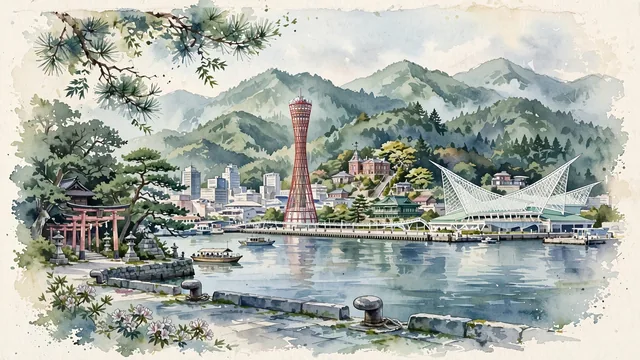
What guided this image
- Landmarks
- Kobe Port Tower; Kobe Maritime Museum; Western-style; Ikuta Shrine; Mount Rokko; Kobe Harbor; lush Kansai coastal and montane flora; Meiji
- Viewpoint
- Favor the classic viewpoint looking across Kobe Harbor toward Meriken Park with Kobe Port Tower and the Maritime Museum in the middle-ground and the forested ridges of Mount Rokko rising in the background, showing pine tree branches and stone pier bollards in the foreground, the calm bay waters and architectural landmarks in the middle-ground, and the lush mountain slopes fading in the background.
- Palette
- Green should be the predominant color, especially in the thick pine and cedar forests of Mount Rokko, Ikuta Forest camphor trees, and waterfront park lawns.
- Guarded against
- Not Osaka, Kyoto, or Yokohama
Population1,525,152Wikidata: 1,521,707
Coordinates34.69°N, 135.18°E
Area552,230,000 km²
Time zoneAsia/TokyoUTC+9
Solar noon11:59clock runs 0.0 h behind the sun
Through the Earth
Dig straight through the Earth from Kobe and you surface in open ocean, nearest to Mostardas, Brazil — 695 km from the exact antipodal point.
Nearest cities in the atlas
| Osaka | JP | 29 km |
| Kyoto | JP | 64 km |
| Nagoya | JP | 167 km |
| Hiroshima | JP | 252 km |
| Yokohama | JP | 415 km |
| Kawasaki | JP | 423 km |
| Tokyo | JP | 425 km |
| Saitama | JP | 429 km |
Twinned cities
- Barcelona ES
- Brisbane AU
- Faisalabad PK
- Incheon KR
- Philadelphia US
- Riga LV
- Rio de Janeiro BR
- Tianjin CN
8 of 13 twinned cities are in this atlas. See the full network →