
City
Bucharest
Capital of Romania
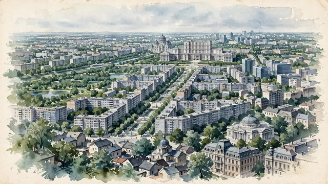
What guided this image
- Landmarks
- Palace of the Parliament; People's Salvation Cathedral; Unirii Boulevard; Old Town; Romanian Athenaeum and the Belle Époque; Communist-era; Belle Époque; Cișmigiu and Herăstrău
- Viewpoint
- Favor a slightly elevated viewpoint above Piața Unirii, looking west across rooftops and tree canopy along Unirii Boulevard toward the Palace of the Parliament.
- Palette
- Green should be the predominant color, especially in the dense street trees, the parks, and the overall visual impression.
- Guarded against
- Avoid making Bucharest look like Paris, Budapest, Vienna, or Moscow, and avoid Mediterranean or Alpine character.
Population1,877,155Wikidata: 30,000
Coordinates44.43°N, 26.11°E
Elevation70 m
Area226 km²
Time zoneEurope/BucharestUTC+2
Solar noon12:16clock runs 0.3 h ahead of the sun
Through the Earth
Dig straight through the Earth from Bucharest and you surface in open ocean, nearest to Waitangi, New Zealand — 1,802 km from the exact antipodal point.
Nearest cities in the atlas
| Sofia | BG | 296 km |
| Chisinau | MD | 358 km |
| Odesa | UA | 428 km |
| Pristina | XK | 444 km |
| Istanbul | TR | 445 km |
| Belgrade | RS | 448 km |
| Skopje | MK | 466 km |
| Bursa | TR | 529 km |
Twinned cities
- Amman JO
- Ankara TR
- Athens GR
- Beijing CN
- Budapest HU
- Chisinau MD
- Damascus SY
- Istanbul TR
- Lagos NG
- London GB
- Manila PH
- Montréal CA
- Moscow RU
- Rio de Janeiro BR
- São Paulo BR
- Sofia BG
- Tbilisi GE
- Tirana AL
18 of 24 twinned cities are in this atlas. See the full network →