
City
Edmonton
Canada
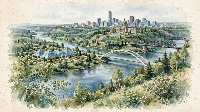
What guided this image
- Landmarks
- Muttart Conservatory; High Level Bridge; Alberta Legislature Building; North Saskatchewan River; Stantec Tower; lush Canadian prairie and boreal transition flora
- Viewpoint
- Favor the classic viewpoint from Gallagher Park or the south valley slope looking north across the river toward downtown, showing aspen foliage and grassy hillsides in the foreground, the four glass Muttart pyramids, Walterdale Bridge, and river waters in the middle-ground, and the stately Legislature dome and downtown skyline rising atop the bluff in the background.
- Palette
- Green should be the predominant color, especially in the vast forested slopes of the North Saskatchewan River Valley, park lawns, and spruce groves.
- Guarded against
- Not Calgary, Vancouver, or Winnipeg
Population1,010,899Wikidata: 812,201
Coordinates53.55°N, 113.47°W
Elevation645 m
Area768 km²
Time zoneAmerica/EdmontonUTC−7
Solar noon12:34clock runs 0.6 h ahead of the sun
Through the Earth
Dig straight through the Earth from Edmonton and you surface in open ocean, nearest to Port-aux-Français, French Southern and Antarctic Lands — 532 km from the exact antipodal point.
Nearest cities in the atlas
| Calgary | CA | 281 km |
| Los Angeles | US | 2,201 km |
| Phoenix | US | 2,238 km |
| Chicago | US | 2,309 km |
| Mexicali | MX | 2,332 km |
| San Diego | US | 2,335 km |
| Tijuana | MX | 2,357 km |
| Ciudad Juárez | MX | 2,491 km |
Twinned cities
- Harbin CN
1 of 6 twinned cities are in this atlas. See the full network →