
City
Calgary
Canada
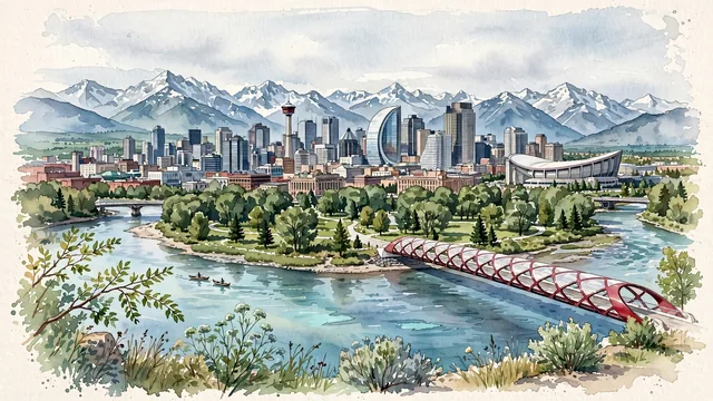
What guided this image
- Landmarks
- Calgary Tower; Peace Bridge; Historic Central Memorial Library; Scotiabank Saddledome; Prince's Island Park; Bow Building; Bow River; Canadian Rocky Mountains
- Viewpoint
- Favor the classic elevated viewpoint from Crescent Heights Lookout (McHugh Bluff) looking south across the Bow River toward downtown and the Rocky Mountains, showing cottonwood branches and riverbanks in the foreground, Peace Bridge and downtown skyscrapers in the middle-ground, and the snow-capped Rockies rising in the background.
- Palette
- Green should be the predominant color, especially in the thick cottonwood canopies of Prince's Island Park, riverbank meadows, and spruce groves in the foothills.
- Guarded against
- Not Edmonton, Vancouver, or Denver
Population1,306,784Wikidata: 1,096,833
Coordinates51.05°N, 114.09°W
Elevation1,045 m
Area825,290,000 km²
Time zoneAmerica/EdmontonUTC−7
Solar noon12:36clock runs 0.6 h ahead of the sun
Through the Earth
Dig straight through the Earth from Calgary and you surface nearest to Port-aux-Français, French Southern and Antarctic Lands — 360 km from the exact antipodal point.
Nearest cities in the atlas
| Edmonton | CA | 281 km |
| Los Angeles | US | 1,920 km |
| Phoenix | US | 1,964 km |
| Mexicali | MX | 2,051 km |
| San Diego | US | 2,054 km |
| Tijuana | MX | 2,076 km |
| Ciudad Juárez | MX | 2,239 km |
| Chicago | US | 2,252 km |
Twinned cities
5 of 8 twinned cities are in this atlas. See the full network →