
City
San Diego
United States
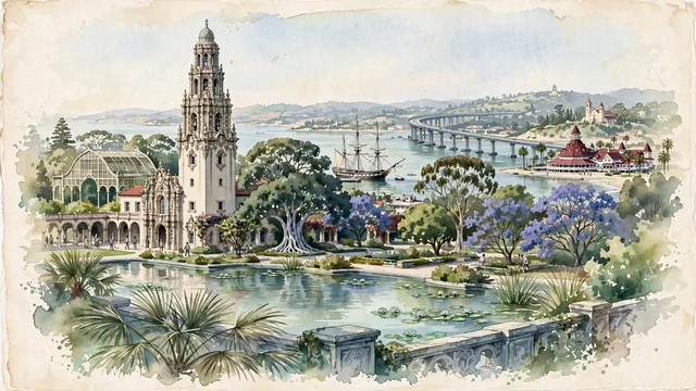
What guided this image
- Landmarks
- California Building and Tower; San Diego-Coronado Bay Bridge; Star of India; Hotel del Coronado; Mission Basilica San Diego de Alcalá; Southern California flora; Spanish-Colonial Revival
- Viewpoint
- Favor the classic viewpoint looking across the landscape toward the signature landmarks of San Diego, showing regional foliage and foreground textures, the iconic architectural monuments in the middle-ground, and the distant horizon fading in the background.
- Palette
- Green should be the predominant color, especially in California fan palms, flowering jacarandas, and giant Moreton Bay fig trees in Balboa Park.
Population1,404,452Wikidata: 1,345,895
Coordinates32.72°N, 117.16°W
Elevation422 m
Area964 km²
Time zoneAmerica/Los_AngelesUTC−8
Solar noon11:49clock runs 0.2 h behind the sun
Through the Earth
Dig straight through the Earth from San Diego and you surface in open ocean, nearest to Saint-Philippe, Réunion — 1,443 km from the exact antipodal point.
Nearest cities in the atlas
| Tijuana | MX | 29 km |
| Mexicali | MX | 160 km |
| Los Angeles | US | 179 km |
| Phoenix | US | 481 km |
| Ciudad Juárez | MX | 1,012 km |
| Monterrey | MX | 1,809 km |
| San Antonio | US | 1,813 km |
| Fort Worth | US | 1,853 km |
Twinned cities
- Ciudad Juárez MX
- León de los Aldama MX
- Panama City PA
- Quanzhou CN
- Taichung TW
- Tijuana MX
- Warsaw PL
- Yantai CN
- Yokohama JP
9 of 19 twinned cities are in this atlas. See the full network →
This city sits on
- United Statescountry
- 32Nparallel
- UTC−8offset