
City
Fortaleza
Brazil
What guided this image
- Landmarks
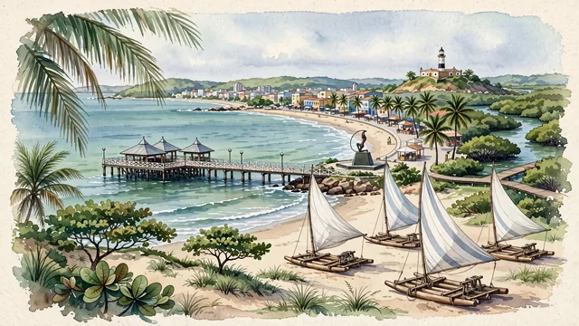
- Ponte dos Ingleses; Statue of Iracema Guardiã; Mucuripe Lighthouse; Cocó Ecological Park; Avenida Beira Mar; lush tropical coastal flora; Tabajara
- Viewpoint
- Favor the classic viewpoint looking along the curving beach of Praia de Iracema or Mucuripe toward the ocean, showing coconut palm fronds and sandy dunes in the foreground, the wooden pier of Ponte dos Ingleses, traditional jangadas, and ocean waves in the middle-ground, and the distant coastal headland and lighthouse fading in the background.
- Palette
- Green should be the predominant color, especially in the thick coconut palm groves along Beira Mar, dense mangroves of Parque do Cocó, and sea almond trees.
- Guarded against
- Not Recife, Salvador, or Rio de Janeiro
Population2,400,000Wikidata: 2,591,188
Coordinates3.72°S, 38.54°W
Elevation21 m
Area315 km²
Time zoneAmerica/FortalezaUTC−3
Solar noon11:34clock runs 0.4 h behind the sun
Through the Earth
Dig straight through the Earth from Fortaleza and you surface nearest to Eauripik, Federated States of Micronesia — 374 km from the exact antipodal point.
Nearest cities in the atlas
| Recife | BR | 629 km |
| Maceió | BR | 730 km |
| Salvador | BR | 1,030 km |
| Belém | BR | 1,134 km |
| Brasília | BR | 1,689 km |
| Goiânia | BR | 1,856 km |
| Belo Horizonte | BR | 1,894 km |
| Paramaribo | SR | 2,132 km |
Twinned cities
Wikidata records no twinned cities for Fortaleza inside this atlas.