
City
Maceió
Brazil
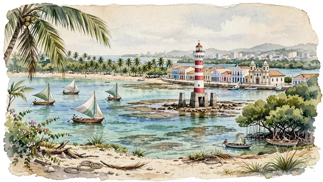
What guided this image
- Landmarks
- Pajuçara Beach and Ponta Verde Beach; Brazilian; Farol da Ponta Verde; Nossa Senhora Mãe do Povo; Mundaú Lagoon; lush coastal Brazilian Atlantic flora
- Viewpoint
- Favor the classic viewpoint looking across the landscape toward the signature landmarks of Maceió, showing regional foliage and foreground textures, the iconic architectural monuments in the middle-ground, and the distant horizon fading in the background.
- Palette
- Green should be the predominant color, especially in thick coconut palm groves lining the shoreline, sea almond trees, and coastal mangroves.
Population1,031,597
Coordinates9.67°S, 35.74°W
Time zoneAmerica/MaceioUTC−3
Solar noon11:23clock runs 0.6 h behind the sun
Through the Earth
Dig straight through the Earth from Maceió and you surface nearest to Faraulep, Federated States of Micronesia — 123 km from the exact antipodal point.
Nearest cities in the atlas
| Recife | BR | 203 km |
| Salvador | BR | 475 km |
| Fortaleza | BR | 730 km |
| Belo Horizonte | BR | 1,440 km |
| Brasília | BR | 1,486 km |
| Goiânia | BR | 1,656 km |
| Rio de Janeiro | BR | 1,672 km |
| Belém | BR | 1,680 km |
Twinned cities
Wikidata records no twinned cities for Maceió inside this atlas.
This city sits on