
City
Salvador
Brazil
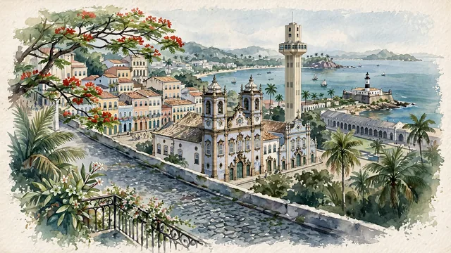
What guided this image
- Landmarks
- UNESCO World Heritage; Church and Convent of São Francisco; Elevador Lacerda; Farol da Barra; traditional Bahian architecture; tropical Bahian coastal flora; Afro-Brazilian
- Viewpoint
- Favor the classic viewpoint looking across the landscape toward the signature landmarks of Salvador, showing regional foliage and foreground textures, the iconic architectural monuments in the middle-ground, and the distant horizon fading in the background.
- Palette
- Green should be the predominant color, especially in flowering royal poinciana (flamboyant), coconut palms along the bay, and imperial palms.
Population2,711,840Wikidata: 2,443,107
Coordinates12.98°S, 38.49°W
Elevation8 m
Area693 km²
Time zoneAmerica/BahiaUTC−3
Solar noon11:34clock runs 0.4 h behind the sun
Through the Earth
Dig straight through the Earth from Salvador and you surface nearest to Umatac Village, Guam — 343 km from the exact antipodal point.
Nearest cities in the atlas
| Maceió | BR | 475 km |
| Recife | BR | 675 km |
| Belo Horizonte | BR | 966 km |
| Fortaleza | BR | 1,030 km |
| Brasília | BR | 1,063 km |
| Rio de Janeiro | BR | 1,210 km |
| Goiânia | BR | 1,227 km |
| Campinas | BR | 1,428 km |
Twinned cities
- Chongqing CN
- Lisbon PT
- Los Angeles US
- Philadelphia US
4 of 11 twinned cities are in this atlas. See the full network →