
City
Giza
Egypt
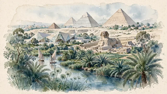
What guided this image
- Landmarks
- Pyramids of Giza; Great Sphinx; Grand Egyptian Museum; Nile River; Nile River; Giza; lush Egyptian floodplain and desert oasis flora; Old Kingdom
- Viewpoint
- Favor the classic viewpoint looking from the green palm-fringed irrigation canals at the base of the plateau up toward the Pyramids and Sphinx, showing date palm fronds and canal waters in the foreground, the Great Sphinx and lower temples in the middle-ground, and the colossal geometric triangular silhouettes of the Pyramids rising against the soft sky in the background.
- Palette
- Green should be the predominant color, especially in the thick date palm groves along the Nile floodplain, eucalyptus canopies, and agricultural fields at the foot of the plateau.
- Guarded against
- Not Cairo proper, Luxor, or Aswan
Population4,367,343Wikidata: 3,021,542
Coordinates30.01°N, 31.21°E
Elevation30 m
Area187 km²
Time zoneAfrica/CairoUTC+2
Solar noon11:55clock runs 0.1 h behind the sun
Through the Earth
Dig straight through the Earth from Giza and you surface in open ocean, nearest to Mataura, French Polynesia — 744 km from the exact antipodal point.
Nearest cities in the atlas
| Cairo | EG | 7 km |
| Shubrā al Khaymah | EG | 14 km |
| Alexandria | EG | 181 km |
| Jerusalem | IL | 430 km |
| East Jerusalem | PS | 431 km |
| Ramallah | PS | 435 km |
| Amman | JO | 501 km |
| Beirut | LB | 591 km |
Twinned cities
- Istanbul TR
- Los Angeles US
2 of 2 twinned cities are in this atlas. See the full network →