
City
Mandalay
Myanmar
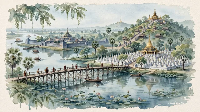
What guided this image
- Landmarks
- U Bein Bridge; Mandalay Hill; Mandalay Royal Palace; UNESCO-recognized Kuthodaw Pagoda; Mahamuni Buddha Temple; Irrawaddy River; lush Central Burmese dry-zone and riverine flora; Konbaung
- Viewpoint
- Favor the classic viewpoint looking across the landscape toward the signature landmarks of Mandalay, showing regional foliage and foreground textures, the iconic architectural monuments in the middle-ground, and the distant horizon fading in the background.
- Palette
- Green should be the predominant color, especially in ancient rain trees around the lake, toddy palms, and sacred bodhi trees.
Population1,208,099Wikidata: 1,225,546
Coordinates21.97°N, 96.08°E
Elevation22 m
Area164 km²
Time zoneAsia/YangonUTC+6:30
Solar noon12:06clock runs 0.1 h ahead of the sun
Through the Earth
Dig straight through the Earth from Mandalay and you surface in open ocean, nearest to San Juan, Peru — 1,178 km from the exact antipodal point.
Nearest cities in the atlas
| Nay Pyi Taw | MM | 247 km |
| Chattogram | BD | 440 km |
| Comilla | BD | 528 km |
| Yangon | MM | 574 km |
| Dhaka | BD | 612 km |
| Gazipur | BD | 622 km |
| Khulna | BD | 677 km |
| Kunming | CN | 758 km |
Twinned cities
- Kunming CN
1 of 1 twinned cities are in this atlas. See the full network →