
City
Nay Pyi Taw
Capital of Myanmar
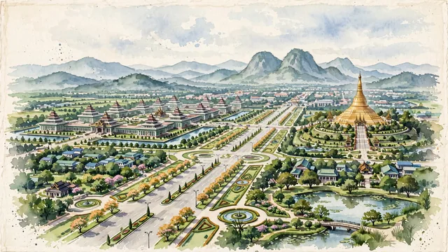
What guided this image
- Landmarks
- Uppatasanti Pagoda; Parliament Complex; National Landmark Garden; Shan Hills; Burmese
- Viewpoint
- Favor an elevated viewpoint overlooking one of the grand boulevards toward the Uppatasanti Pagoda or the Parliament complex, capturing the colossal scale of the planned landscape, the green verges, and the gentle Shan Hills in the background.
- Palette
- Green should be the predominant color, especially in the vast manicured parklands, road medians, teak plantations, and surrounding mountain slopes.
- Guarded against
- Not historic Yangon or ancient Bagan
Population925,000Wikidata: 1,160,242
Coordinates19.75°N, 96.13°E
Elevation115 m
Area7,054 km²
Time zoneAsia/YangonUTC+6:30
Solar noon12:05clock runs 0.1 h ahead of the sun
Through the Earth
Dig straight through the Earth from Nay Pyi Taw and you surface in open ocean, nearest to Paracas, Peru — 1,040 km from the exact antipodal point.
Nearest cities in the atlas
| Mandalay | MM | 247 km |
| Yangon | MM | 327 km |
| Chattogram | BD | 531 km |
| Comilla | BD | 656 km |
| Vientiane | LA | 709 km |
| Dhaka | BD | 737 km |
| Gazipur | BD | 755 km |
| Khulna | BD | 761 km |
Twinned cities
Wikidata records no twinned cities for Nay Pyi Taw inside this atlas.