
City
Chattogram
Bangladesh
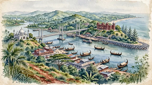
What guided this image
- Landmarks
- Foy's Lake; Port of Chittagong; Mughal-style Anderkilla Shahi Jame Mosque; Chittagong Court Building; Batali Hill; Patenga Beach; Bengali; lush tropical flora
- Viewpoint
- Favor the classic elevated viewpoint from Batali Hill or Court Hill looking across the Karnaphuli River toward the port and Bay of Bengal, showing tropical palm fronds in the foreground, the sweeping river with wooden sampan boats and Shah Amanat Bridge in the middle-ground, and the rolling green hills and ocean horizon in the background.
- Palette
- Green should be the predominant color, especially in the lush forested slopes of Foy's Lake and Batali Hill, coconut palms, and mangrove riverbanks.
- Guarded against
- Avoid confusing Chattogram with flat delta towns (Chattogram is famously undulating with steep green hills dropping into a major deepwater river estuary).
Population3,920,222Wikidata: 2,581,643
Coordinates22.34°N, 91.83°E
Elevation6 m
Area161 km²
Time zoneAsia/DhakaUTC+6
Solar noon11:53clock runs 0.1 h behind the sun
Through the Earth
Dig straight through the Earth from Chattogram and you surface in open ocean, nearest to San Juan Bautista, Chile — 1,554 km from the exact antipodal point.
Nearest cities in the atlas
| Comilla | BD | 141 km |
| Dhaka | BD | 211 km |
| Gazipur | BD | 234 km |
| Khulna | BD | 239 km |
| Kolkata | IN | 357 km |
| Howrah | IN | 362 km |
| Mandalay | MM | 440 km |
| Rangpur | BD | 461 km |
Twinned cities
3 of 3 twinned cities are in this atlas. See the full network →
This city sits on
- Bangladeshcountry
- 22Nparallel
- UTC+6offset