
City
Auckland
New Zealand
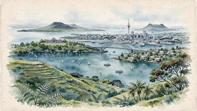
What guided this image
- Landmarks
- Sky Tower; Waitematā Harbour; Rangitoto Island; Auckland Harbour Bridge; Mount Eden; Auckland War Memorial Museum; lush native flora; Victorian and Edwardian
- Viewpoint
- Favor the classic elevated viewpoint from Mount Eden (Maungawhau) or from across the harbor at Devonport (Mount Victoria), showing lush green volcanic slopes or coastal pōhutukawa trees in the foreground, the downtown skyline with the Sky Tower in the middle-ground, and the iconic silhouette of Rangitoto Island on the water in the background.
- Palette
- Green should be the predominant color, especially in the grassy volcanic crater slopes of Mount Eden, Auckland Domain parklands, and coastal pōhutukawa trees.
- Guarded against
- Avoid confusing Auckland with Wellington (Auckland has wide volcanic cones, two open harbors, and the Sky Tower; not steep enclosed amphitheater hills).
Population1,547,200Wikidata: 1,467,800
Coordinates36.85°S, 174.76°E
Elevation196 m
Area559 km²
Time zonePacific/AucklandUTC+13
Solar noon13:21clock runs 1.3 h ahead of the sun
Through the Earth
Dig straight through the Earth from Auckland and you surface nearest to Setenil de las Bodegas, Spain — 6 km from the exact antipodal point.
Nearest cities in the atlas
| Wellington | NZ | 494 km |
| Nuku‘alofa | TO | 1,998 km |
| Suva | FJ | 2,111 km |
| Sydney | AU | 2,156 km |
| Port-Vila | VU | 2,217 km |
| Brisbane | AU | 2,288 km |
| Canberra | AU | 2,303 km |
| Melbourne | AU | 2,626 km |
Twinned cities
9 of 20 twinned cities are in this atlas. See the full network →
This city sits on
- New Zealandcountry
- 37Sparallel
- UTC+13offset