
City
Ciudad de la Paz
Capital of Equatorial Guinea
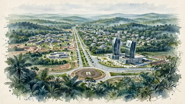
What guided this image
- Landmarks
- Grand Hotel Djibloho
- Viewpoint
- Favor a slightly elevated viewpoint from a forested rise at the edge of the city, looking across the boulevards and new buildings toward the unbroken rainforest beyond.
- Palette
- Green should be the predominant color, especially in the surrounding rainforest, the landscaped boulevards, and the overall visual impression.
- Guarded against
- Avoid making it look like a Gulf state city, a Latin American colonial town, or a European suburb, and avoid Mediterranean or Alpine character.
Population2,000
Coordinates1.59°N, 10.82°E
Elevation454 m
Area82 km²
Time zoneAfrica/MalaboUTC+1
Solar noon12:17clock runs 0.3 h ahead of the sun
Through the Earth
Dig straight through the Earth from Ciudad de la Paz and you surface in open ocean, nearest to Atafu Village, Tokelau — 857 km from the exact antipodal point.
Nearest cities in the atlas
| Libreville | GA | 202 km |
| Yaoundé | CM | 265 km |
| Douala | CM | 300 km |
| São Tomé | ST | 475 km |
| Aba | NG | 548 km |
| Port Harcourt | NG | 552 km |
| Onitsha | NG | 676 km |
| Pointe-Noire | CG | 718 km |
Twinned cities
Wikidata records no twinned cities for Ciudad de la Paz inside this atlas.
This city sits on
- Equatorial Guineacountry
- 1Nparallel
- UTC+1offset