
City
Guarulhos
Brazil
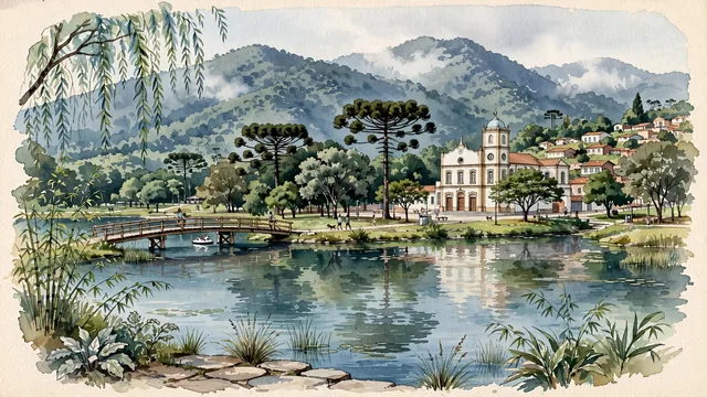
What guided this image
- Landmarks
- Bosque Maia; Cathedral of Our Lady of the Conception; Lago dos Patos; Serra da Cantareira; Trem das Onze; lush Brazilian Atlantic Forest (Mata Atlântica) flora; Atlantic Forest
- Viewpoint
- Favor the classic viewpoint looking across the lake in Bosque Maia toward the wooden bridge and native forest with the Serra da Cantareira rising in the background, showing weeping willow fronds and lake-shore grasses in the foreground, the calm lake waters, wooden footbridge, and park trees in the middle-ground, and the massive, forested mountain wall of Cantareira fading in the background.
- Palette
- Green should be the predominant color, especially in the thick Atlantic rainforest canopies of the Serra da Cantareira, mature trees of Bosque Maia, and Lago dos Patos willows.
- Guarded against
- Not central São Paulo, Campinas, or Santos
Population1,169,577Wikidata: 1,324,781
Coordinates23.46°S, 46.53°W
Elevation759 m
Area318 km²
Time zoneAmerica/Sao_PauloUTC−3
Solar noon12:06clock runs 0.1 h ahead of the sun
Through the Earth
Dig straight through the Earth from Guarulhos and you surface nearest to Zaisho, Japan — 347 km from the exact antipodal point.
Nearest cities in the atlas
| São Paulo | BR | 15 km |
| Campinas | BR | 82 km |
| Rio de Janeiro | BR | 348 km |
| Curitiba | BR | 353 km |
| Belo Horizonte | BR | 476 km |
| Goiânia | BR | 806 km |
| Brasília | BR | 866 km |
| Porto Alegre | BR | 867 km |
Twinned cities
- Quito EC
1 of 2 twinned cities are in this atlas. See the full network →